
Pix4Dfields 1.7: best practices for digital agriculture
Connect to the John Deere Operations Center
In Pix4Dfields 1.7 we are introducing Pix4Dfields connect, space where the outputs of Pix4Dfields are linked to a wider range of online platforms. The first connection we are making available is to John Deere. Jump to section.
“A basis for an action plan”: the case for digital agriculture
Between planting and harvesting, crops go through many different stages. Pix4Dfields bridges that gap. What does it mean to “bridge the gap” in agriculture from the drone mapping perspective?
If you only record planting and harvest data, there is a long period of time in between these stages that still need monitoring to make sure your crops are performing. With Pix4Dfields and a drone, you are fully equipped to monitor and scout fast, in the field - whenever you want and without an internet connection.
“When I don’t fly the drone to check what’s happening on my farm I get nervous. It gives me peace of mind when I see consistently growing crops. On the other hand, if I see discrepancies from what the map should be showing it’s my basis for an action plan. The map tells me where to go on my farm to check for water, nutrients and so on,” says Pix4D’s business developer and farmer Nathan Stein.
Bridging this gap is where the use of drone mapping can truly become a useful tool. With access to fast and accurate data, users can identify issues in time, resulting in improved harvesting, increased crop yields and larger net returns per acre.
So what are the suggested practices to achieve all that?
We’re glad you asked.
A new workflow for digital agriculture
We propose an easy 5 step workflow, achievable with the latest Pix4Dfields 1.7 release:
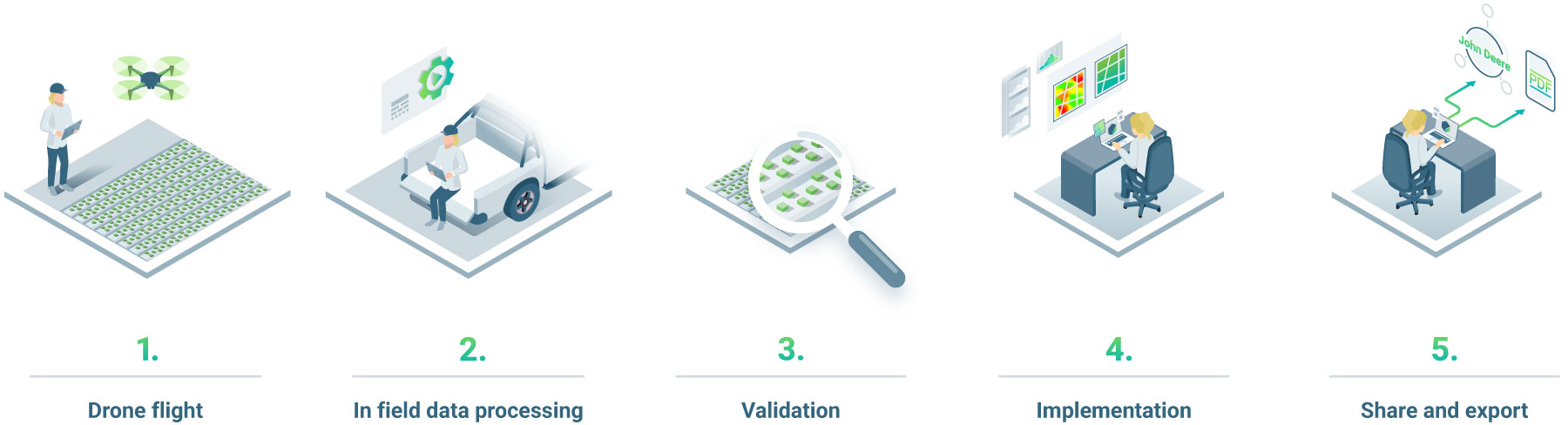
A five-step workflow for digital agriculture
- Fly the drone and collect the data
- Process data in-field
- Validate the data
- Implement the results
- Share and export
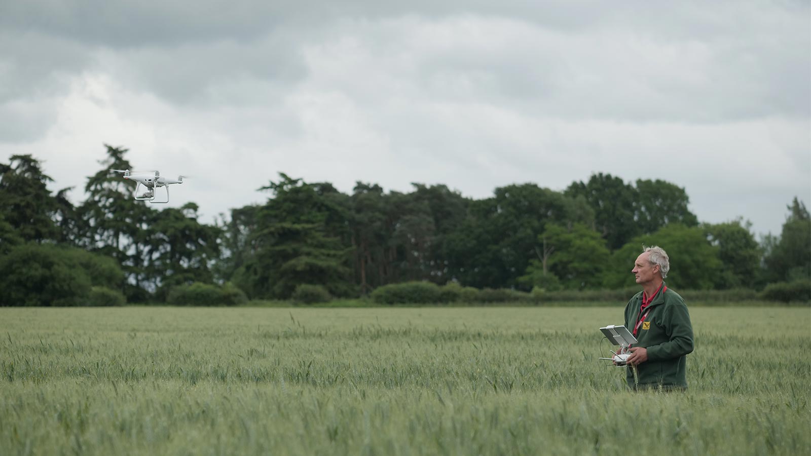
Fly the drone and collect the data
The best (flying) camera is the one you have with you.
Whether you fly a fixed-wing drone (like those from senseFly, Delair and Wingtra) or a rotary UAV (such as those from Parrot or DJI), mounted with an RGB and/or a multispectral camera, the most important thing is to collect the data. Drones enable you to get maps of your fields and crops at any critical stage regardless of satellite availability and cloud cover. Pix4Dfields software is platform agnostic and supports standard RGB and selected multispectral sensors like Parrot Sequoia cameras, MicaSense RedEdge and Altum cameras or DJI P4 multispectral.
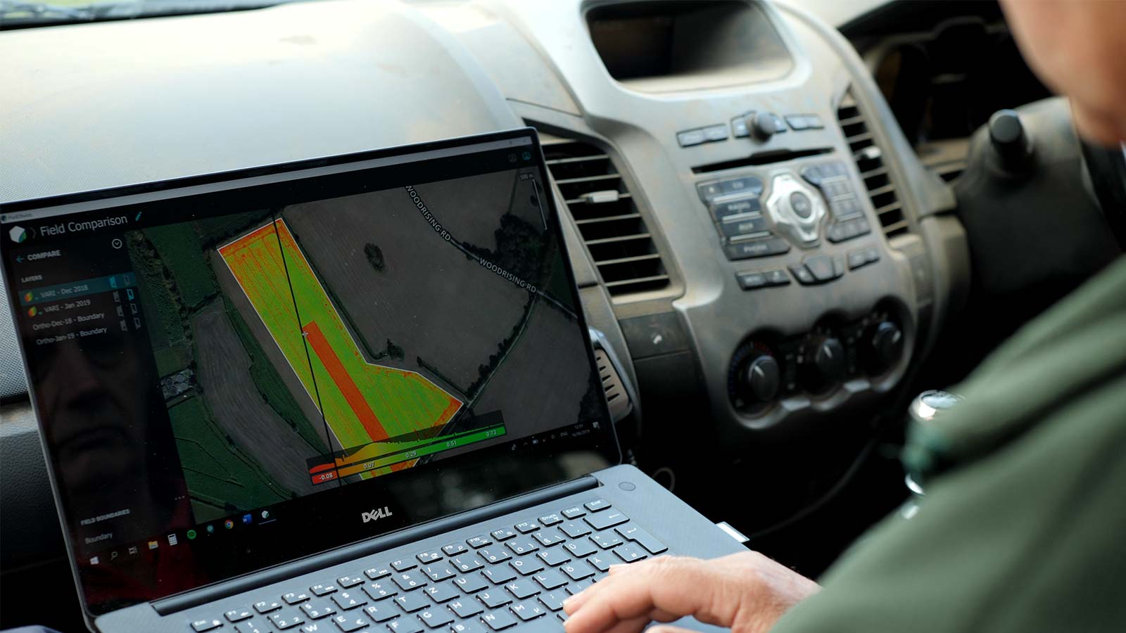
Process data in-field
Once you have the images, you can process them in a matter of minutes on a standard laptop for faster decision making and action, without leaving the field.
Work anywhere and in more languages
Das ist großartig! ¡Eso es genial! それは素晴らしいことです!
To work in your own language, update to Pix4Dfields 1.7 for free, and change the language in the Settings menu.
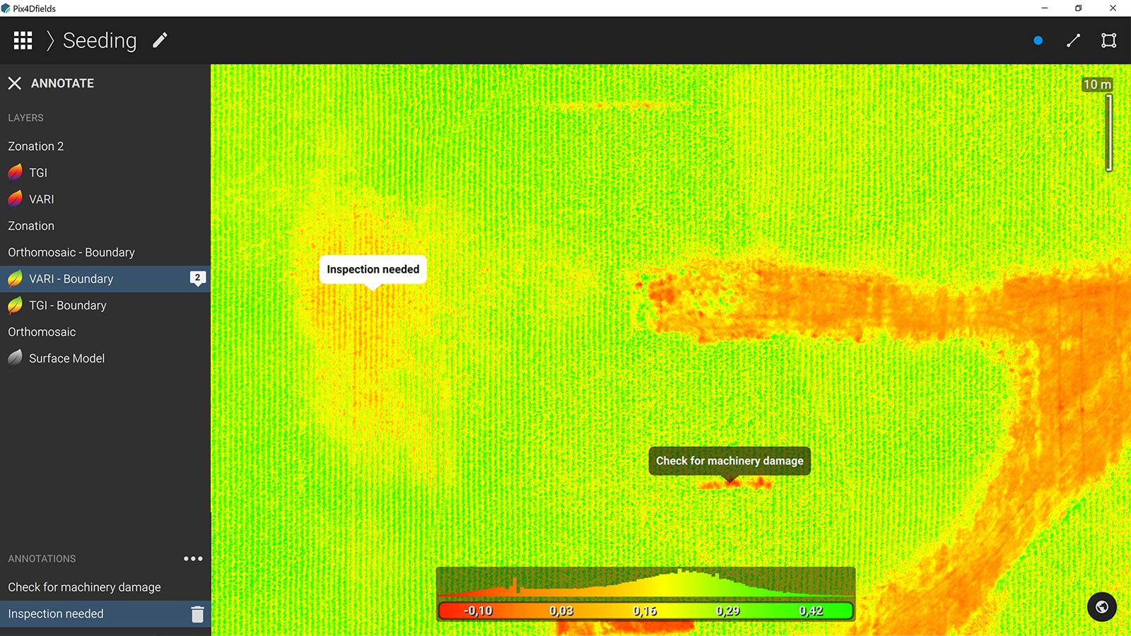
The data is processed - what now? Pix4Dfields comes with a set of features, specifically designed to help your agriculture workflow. With a predefined list of indices and the index calculator, visualizing the crops to check for potential infections, weeds or pests, becomes a more straightforward task. Based on the analytical outputs Pix4Dfields provides, users can take action instantly and go to the identified locations on the farm for further inspection and validation.
Validate the data
Scouting or inspecting the fields can usually be done digitally or by walking them. Digital scouting gives an overview from the air, of the situation on the ground. With the help of index maps and annotations, quick decisions can be made on the spot.
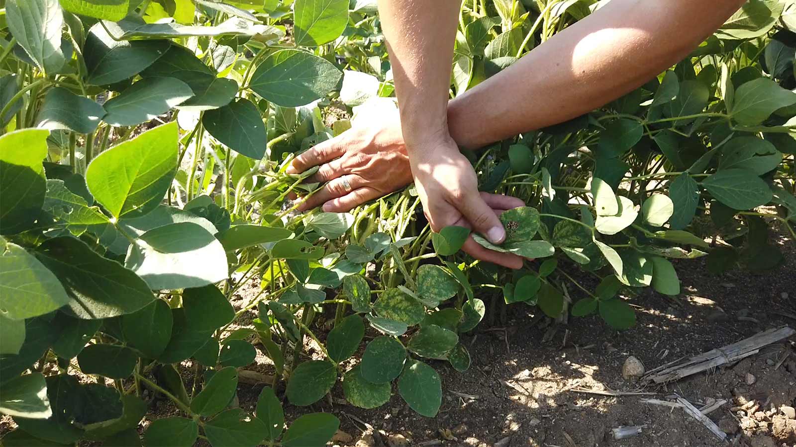
Having the ability to fly over your farm frequently at your own schedule is a huge benefit when time is of the essence. Depending on the size of your farm or accessibility of your crops (if you have crops on steep slopes or crops challenging to walk between) drones can be the only way to scout and prevent.
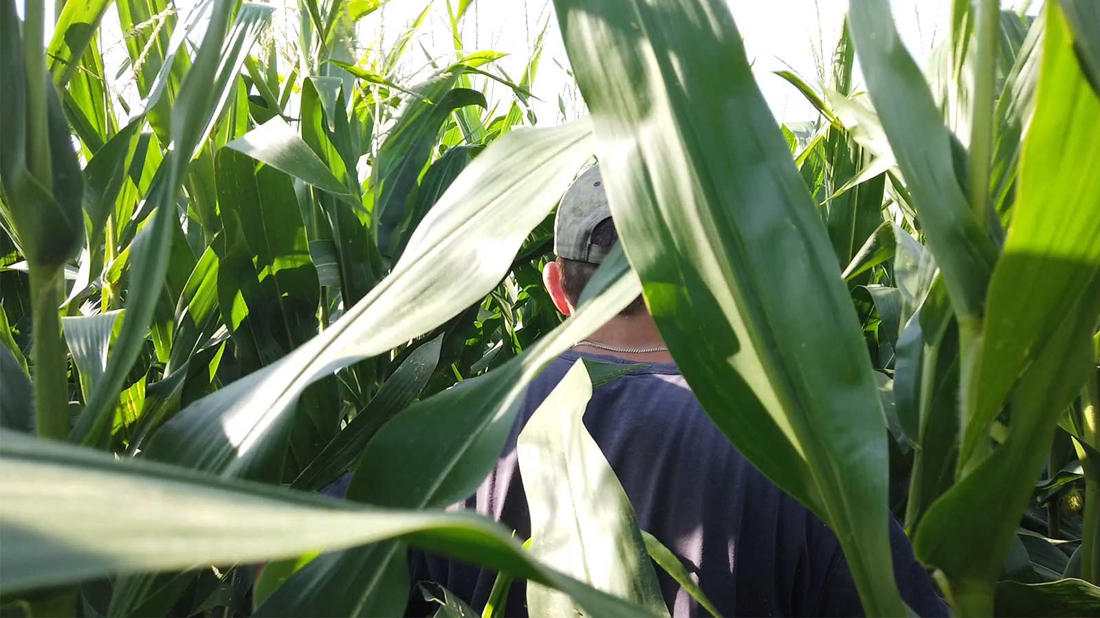
Walking the fields can be done on its own or after a digital scouting flight, focusing on specific areas that were flagged as critical. Additional inspection validates and gives context to the problem. Making sure to prevent issues like pests, diseases, and weeds is critical for the overall crop performance. They don’t say for nothing: “One year’s seed is three years of weed” so prevention and catching on time is key.
Implement the results
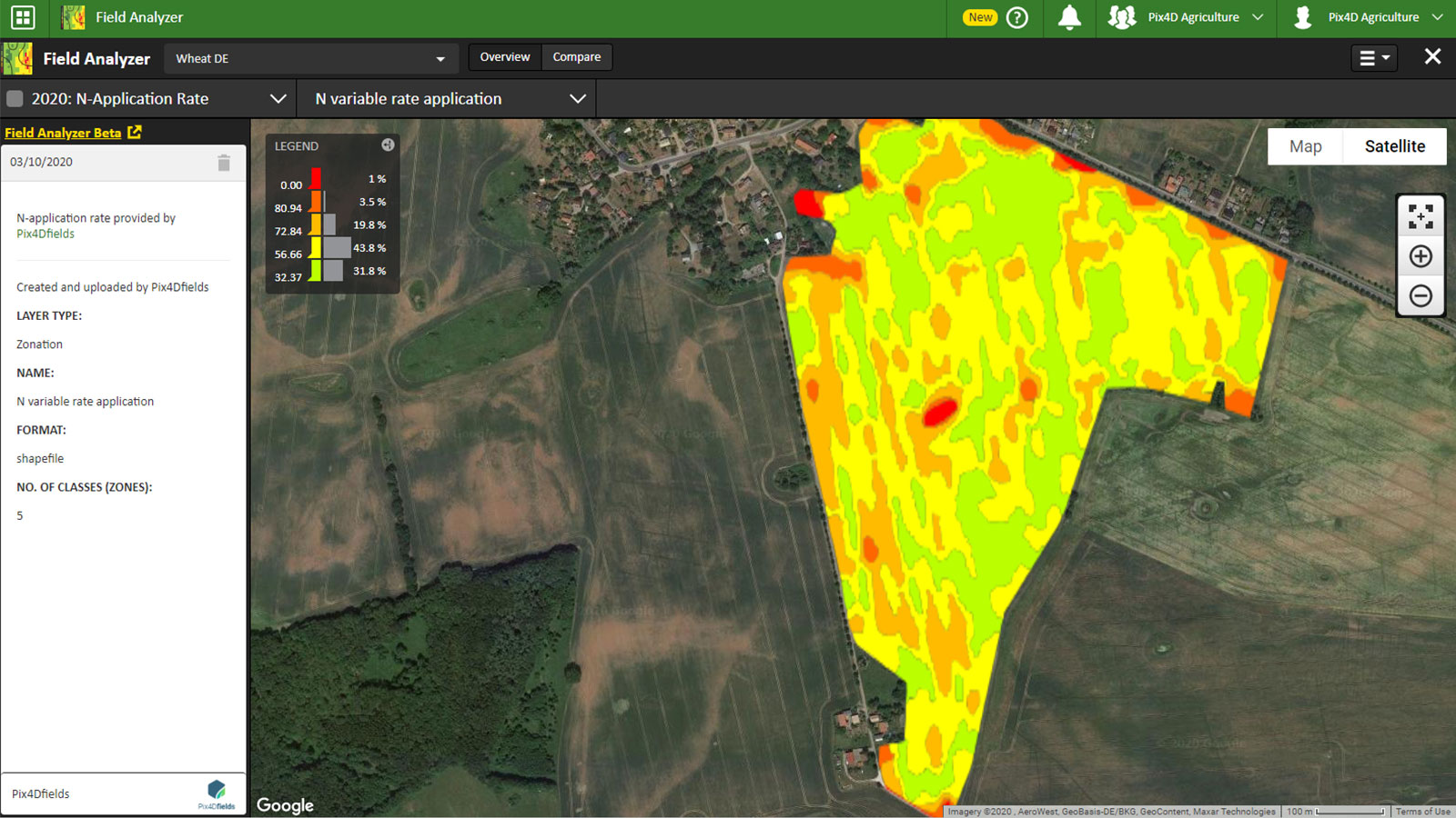
Creating zonation and prescription maps make it easy for farm operations to address the issues they see. These maps are easy to digest for most terminals and farm management platforms. If these maps also help preserve the environment - even better.
The idea is to categorize your farm and fields into areas of different input, yield potentials, etc., based on the maps and values provided by the software and drone data.
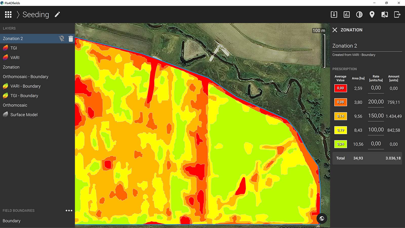
The reality is the entire farm doesn’t perform equally and the inputs like fertilizer, nutrients, and water should be adapted accordingly. Reducing inputs to focus only on specific areas means less cost and less input overload to the soil and crops.
Share and export
In Pix4Dfields 1.7 we are introducing Pix4Dfields connect, space where the outputs of Pix4Dfields are linked to a wider range of online platforms.The first connection we are making available is to John Deere. You can now connect to the John Deere Operations Center and seamlessly upload the maps directly into your farm/field operation. Connecting to a farm management system allows you to further utilize data and visualize it next to your other layers of information (yield maps, soil maps) and make more informed decisions. It can also help in the transfer of prescription files to the machines in the field.
With the ability to connect to the John Deere Operations Center, users can have all the data on a single platform. Having a single repository of the in-field status at any given moment between seeding and harvesting - helps to bridge the uncertainty gap, improve the overall farm health and ultimately crop performance.
If there is a need to create a report - export to PDF for a ready to print or share report. This feature is a great asset for collaboration between teams or informing stakeholders of the work in progress. Add as many maps as you need and use this feature to tell your digital agriculture story.
Connect with us
Are you:
- A service provider with dozens of pilots that would like to scale up operations
- An analytics company that would like to add value on top of the maps generated in Pix4Dfields
- A farming management platform that would like to make it easier for users to send drone maps to your ecosystem
Reach out to us and let us know how you would like to Connect with us. Our business development team will get in touch.
| More information about the latest version of Pix4Dfields can be found in release notes. For more details about all Pix4Dfields features check out the product feature list. |


