Qatar’s Orbital Highway supercharged with PIX4Dengine
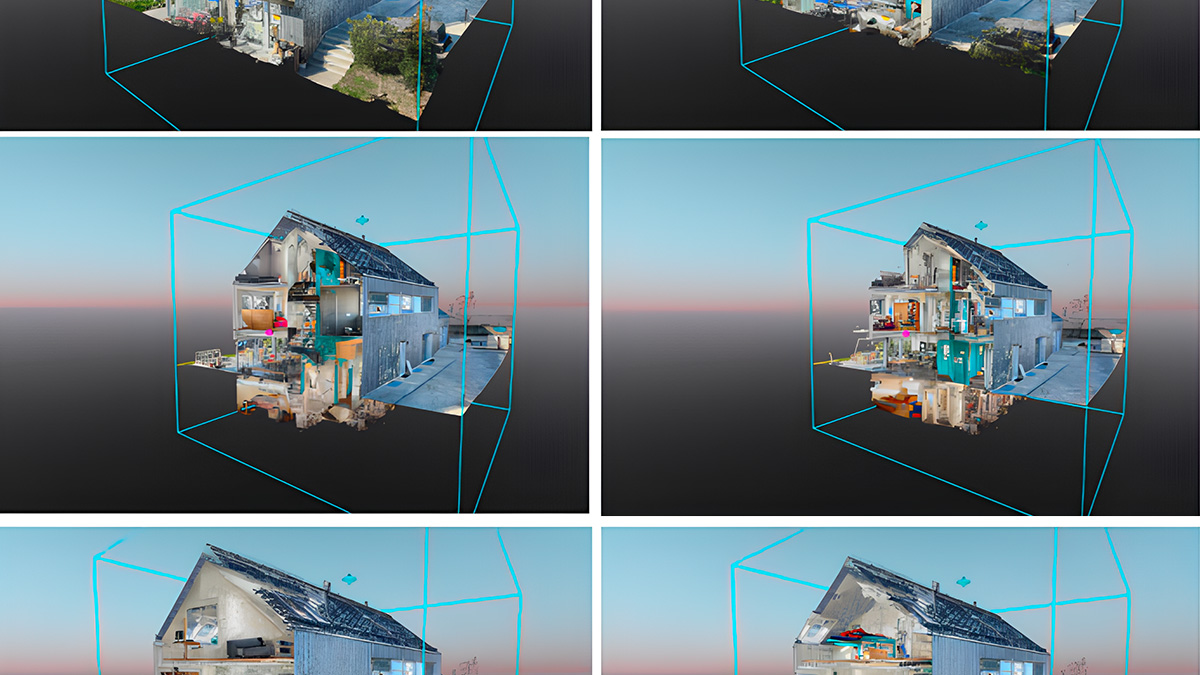
3DR is in the business of helping AEC industry customers reach their goals. The 3DR Site Scan platform uses PIX4Dengine to turn drone images into detailed maps and models and make site survey workflows more streamlined and efficient.
Responding to customer needs
Site Scan is a customer-driven product and the 3DR team frequently visits customers on-site to listen to their pain points and respond to their needs. Many customers needed denser point clouds and better orthomosaics. Another major request is to process large numbers of photos much faster. Last but not least, 3DR’s global customer base demands stable and reliable solutions they can count on day and night across the world.
“Supercharged” with PIX4Dengine
3DR implemented Pix4Dengine and got it working very quickly. PIX4Dengine API and SDK open the power of Pix4D’s processing algorithms to any business and allows customers to access most of Pix4Dmapper desktop features via a scripting code.
For example, 3DR clients use all sorts of cameras and wildly varying numbers of photos, so they need the flexibility which comes with a large selection of settings. DTM generation and point cloud classification was also a huge win for 3DR and their customers.
Last fall, 3DR launched support for ground control points and uses Pix4D to process and geo-correct with them. Another much-used feature is the automatic cropping of areas of interest for further analysis.
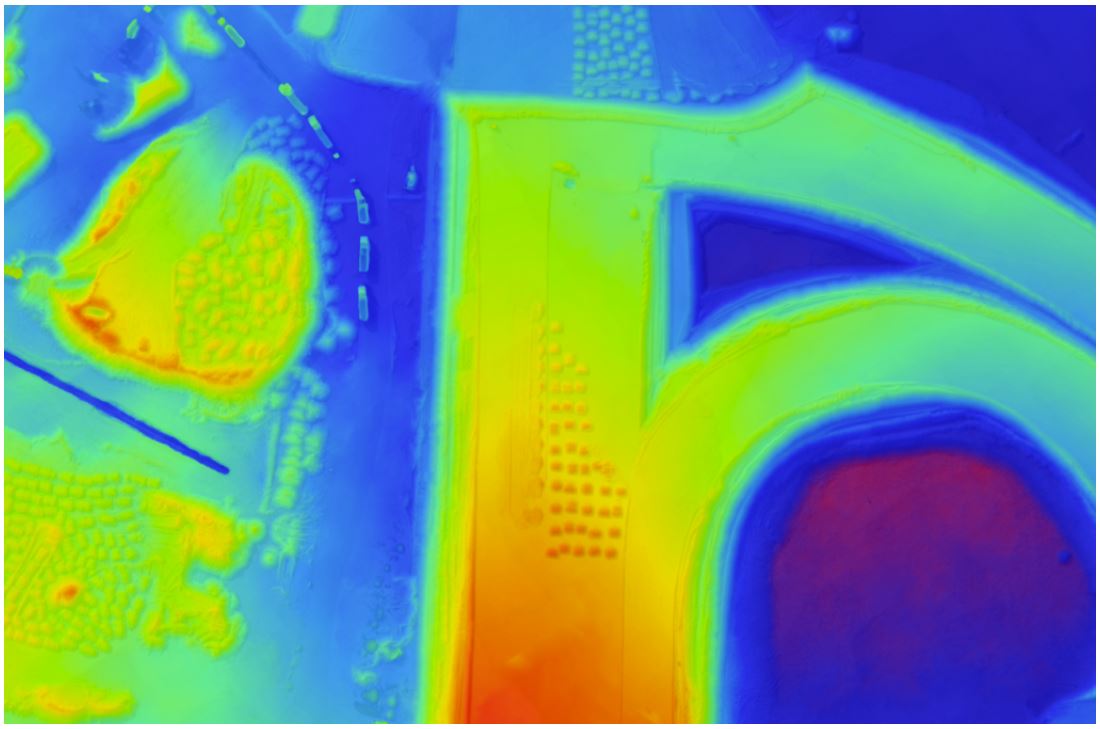
“For example, I find the elevation model helpful for understanding drainage and runoff areas,” said Paul Kawuma, Innovation and Infrastructure BIM Manager at Arcadis.
The limits of photo processing increased from 500 to 2,500 images, which is huge for their customers. Before using Pix4D, a typical construction site with an average of 200 photos took 6-8 hours to process. After Site Scan launched Pix4D processing, the same can be processed in less than an hour: in other words, three times faster.Customers need a reliable solution regardless of where they are in the world, 24/7. Pix4D has offices in Lausanne, San Francisco, Shanghai, Tokyo, Berlin and Madrid. We also offer support in English, Spanish, Chinese, Italian, French, Greek, German and other languages. This global coverage ensures customers questions are addressed in a timely and responsive manner.
“After moving to Pix4D in July 2017 we were thrilled to see dramatic improvements in processing time and quality of our orthomosaics and point clouds. Pix4D’s support team was very helpful and responsive. They worked closely with us to troubleshoot and develop the product. Pix4Dengine has supercharged Site Scan.
“It saved us significant development time and enabled us to release new features and enhancements months sooner. With higher photo limits, GCP support, point cloud classification, bare-earth models and much more our customers are accomplishing days worth of work in hours.” --Jess Lam, Director of Product, 3DR
Customer-driven development
3DR’s product philosophy is to build measurable solutions from the customer’s point of view. Their customer success team was a driving force behind the choice of Pix4D, as many team members are former software and surveying engineers themselves. When customers heard their project is processed by Pix4D, many commented it means the gold standard with the highest quality outputs.
Case study: Orbital Highway in Doha by Arcadis
There’s a construction boom taking place across Qatar, and Arcadis is helping make it possible. The global engineering consultancy, which has over 27,000 employees based in 350 offices across the world, leads infrastructure development projects across Qatar, helping the country meet ambitious construction goals for the 2022 FIFA World Cup™ and for its 2030 National Vision.
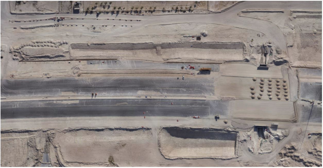
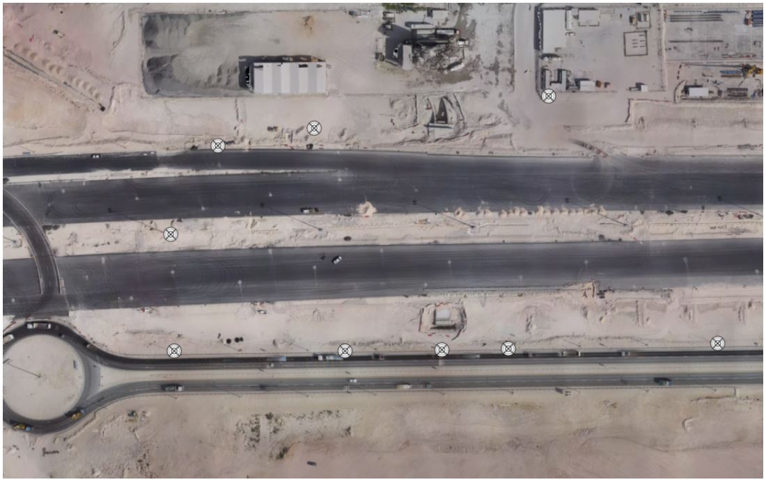
Since 2017, Arcadis has had the opportunity to put drones to work on a project of a massive scale: Contract 2 of the Orbital Highway in the city of Doha, a 14-lane road with five vehicle lanes and two dedicated truck lanes going in each direction. The Orbital spans 46 kilometers in total, and has recently opened to the public, helping reduce congestion and improve travels times.
Arcadis was the lead designer of the Orbital, but their emerging drone operations presented a new business opportunity for this project. Their client, Qatari Diar Vinci Construction (QDVC, a joint venture company between Qatari Diar and Vinci Construction Grands Projets), wanted fast, accurate volumetric calculations for the earthwork spread throughout the entire roadway.
Exceptional outcomes with ground control points
With certified drone operators and a fleet of Site Scan units, Arcadis started work by setting ground control points in order to improve accuracy of their end deliverables. They flew automated nadir surveys with the drone, uploaded the photos to Site Scan Manager, then entered, tagged, and processed the ground control points on the cloud. Cloud-based GCP processing, powered by Pix4D, is far simpler and more efficient than alternative GCP workflows.
In total, the Arcadis team created 34 unique orthomosaics using Pix4Dengine processing capabilities. They then exported their drone data as LAS and TIFF files, and used them in Civil 3D for volumetric calculations.
Key results
Survey and measure earthworks 10X faster
To perform a topographic survey of their test site with a drone, it only took the Arcadis team approximately 20 minutes in the field. Given that it would take 3-4 hours to perform a traditional survey of the same site, Arcadis proved it can cover the same area approximately 10 times faster with a drone. They were able to maintain this level of productivity throughout the entire Orbital project. By speeding up their surveying workflow, Arcadis was able to deliver their volume calculations much faster than usual, helping their client keep the Orbital Highway project on schedule.As Liam Kirk, Business Director at Arcadis, said: “In the market we’re in, we’re realizing that drone surveys can be done 10 times faster than traditional topographic surveys. While we continue to work with licensed surveyors to collect control points and validate accuracy, the drone is a great addition to our platform.”
Improved survey and volume measurement accuracy
Not only were they able to survey faster, but Site Scan, powered by Pix4D, helped create more accurate deliverables compared to a traditional survey. As Paul said: “The drone data was more accurate than a traditional survey when it comes to working on volumes, because it catches more points. This gave us a really dense point cloud compared to the 5 meter grid (separation of points) that we usually get with a traditional survey. This made our client far more comfortable deciding to go with the drone, and ultimately it delivered the results we needed: they were able to use this detailed data to make better, more informed decisions about the project, identify issues and risks quicker, and get a better understanding of future challenges they may face on the project.”
Setting ground control points and processing them in the Site Scan cloud had a significant impact on absolute accuracy: it helped Arcadis georeference their orthomosaics and ensure they reflected reality as closely as possible, thanks to Pix4D’s best-in-class accuracy.
“When it comes to ease and efficiency, drones are taking surveying to a whole new level.” — Liam Kirk, Business Director, Arcadis
| Read more on 3DR's blog |