

Portare la fotogrammetria aerea sul vostro sito
Scoprite la potenza della mappatura da drone e terrestre con PIX4Dcloud, la piattaforma online per il monitoraggio dei progressi e la documentazione del cantiere
Risparmiare tempo e denaro e migliorare la produttività
Portate la fotogrammetria in cantiere
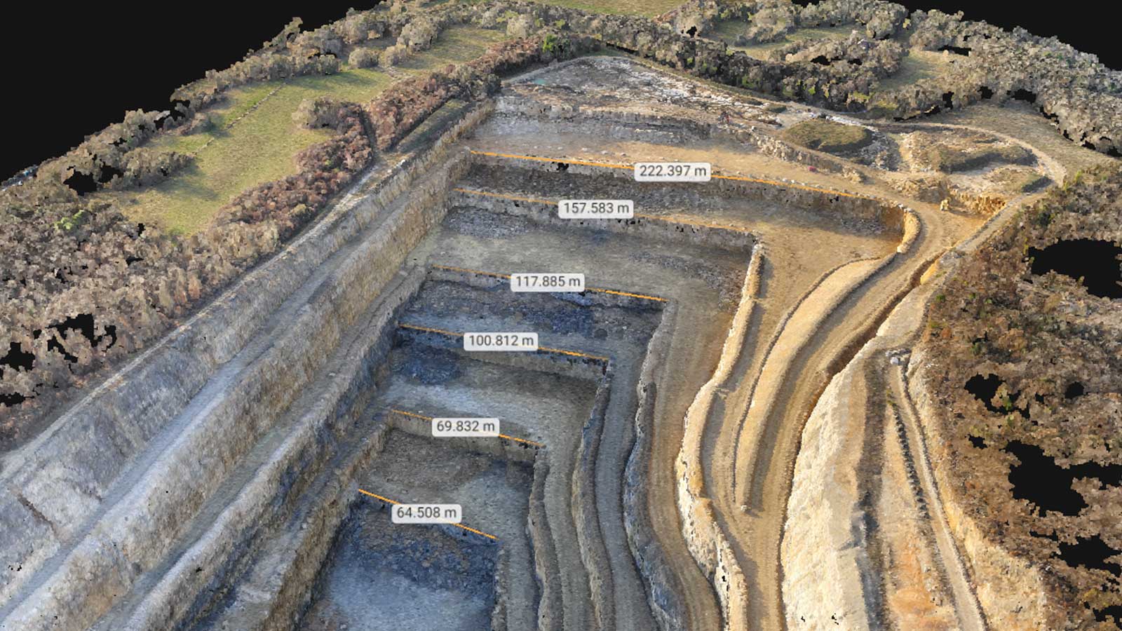
Dati misurabili
Ottenete modelli 2D e 3D accurati, che potete misurare, confrontare, condividere e collaborare. Eseguite verifiche as-built e controlli di qualità.
Documentazione aggiornata
Conservare un archivio visivo permanente del cantiere. Risolvete le controversie con le parti interessate e i clienti in modo più efficiente.
Collaborazione migliorata
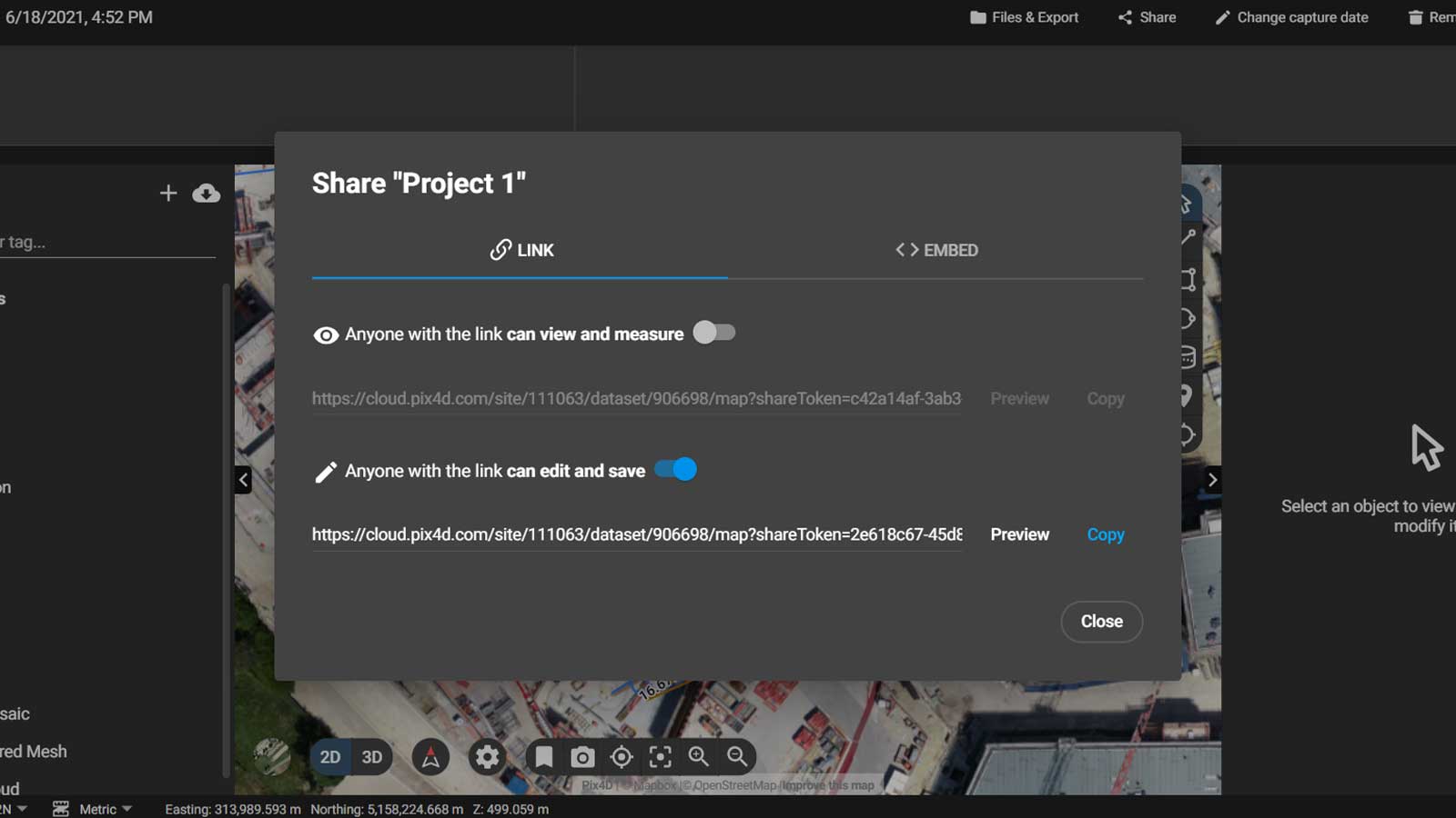
Condividete immediatamente i vostri risultati con chiunque nel mondo, con un semplice link. Il vostro team o i vostri clienti possono vedere e lavorare allo stesso progetto, nello stesso momento, da qualsiasi luogo.
Trusted by thousands of industry leaders
“The speed Pix4Dcloud processes datasets and the ability to share with clients without the need for specialist equipment/software has really helped us to become leaders in this exciting new industry.”
“When surveyors deliver results in a couple of days, drone-mapping takes only a few hours. With a drone, we get the big picture of the overall site. We can quickly collect real-time data from projects to make on-the-ground decisions quicker and identify potential issues before they become costly.”
“Nothing can compare to what Pix4D gives us. The Pix4D solutions allow us to utilize real-time imagery and data to accurately and thoughtfully provide our customers with service programs tailored to their specific site conditions and needs.”
Measure and manage your sites from your office
Track your project's progress with ease
Site progress monitoring
Use the slider to compare two specific days and spot what has changed.
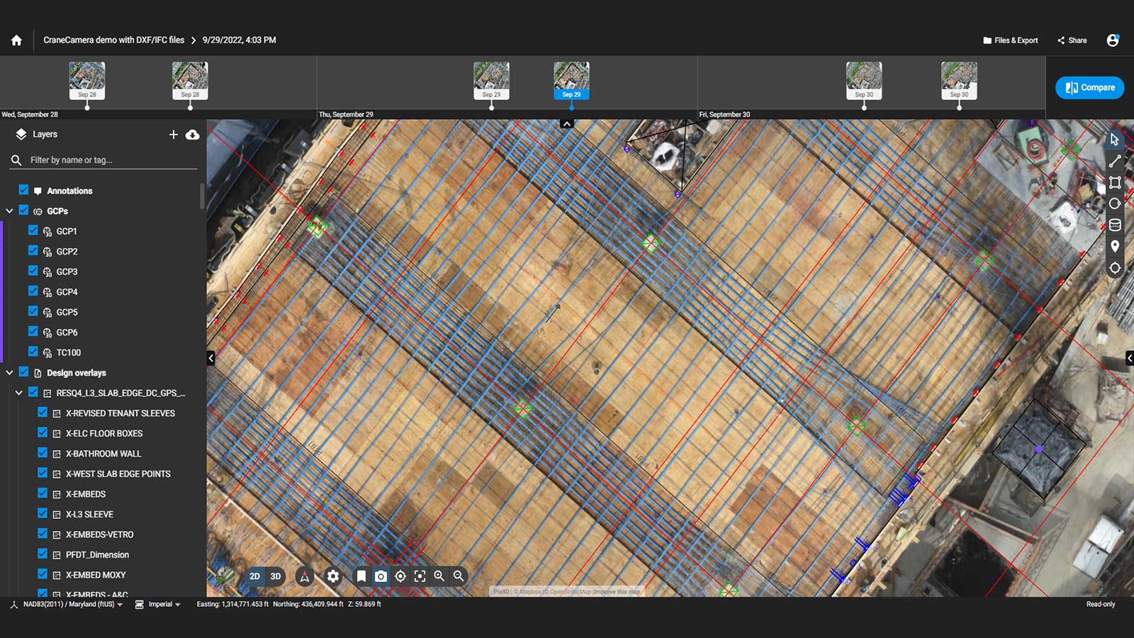
As-built verification
Overlay your CAD drawings and BIM models onto the 2D and 3D renderings to compare the as-built with the as-designed
Virtual inspections
Inspect any jobsite remotely, directly from the original images and identify potential errors.
Operational planning
Get full jobsite awareness in an instant in 2D and 3D to better plan site operations and optimize logistics.
Calculate and compare volumes
Perform quick and precise volume calculations and compare them over time.
Reporting and communication
Access your project data at any time to communicate and report site status with teams in the field and subcontractors.