Pix4D used for innovative architectural design approach
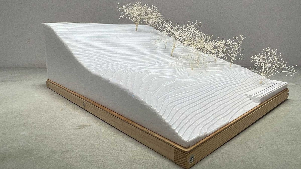
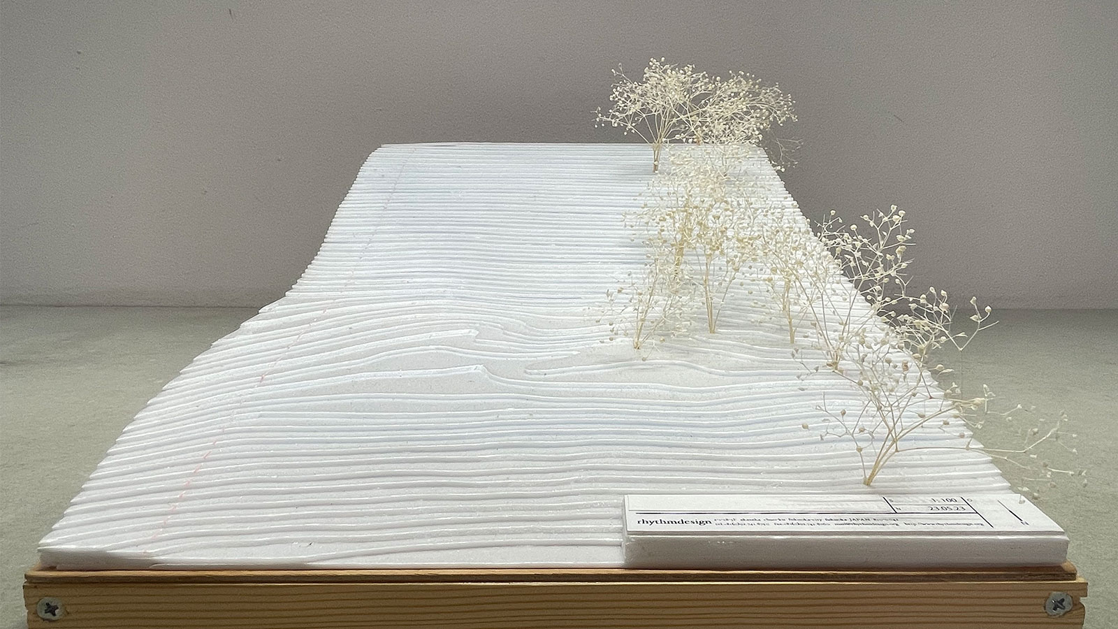
Kouken Geosystem Service, a Fukuoka Prefecture-based company in Japan, employed photogrammetry for a novel architectural design approach. Specializing in providing 3D topographical services to the construction industry, Kouken Geosystem Service was enlisted by Rhythm Design, an architectural design firm, to gain a comprehensive understanding of the topography of an area in Itoshima City using terrestrial data. Leveraging the data collected by Kouken Geosystem Service, Rhythm Design created a terrain model, enhancing their grasp of the area and enabling a foundation design that reduced the need for additional structures, thus streamlining the construction process.
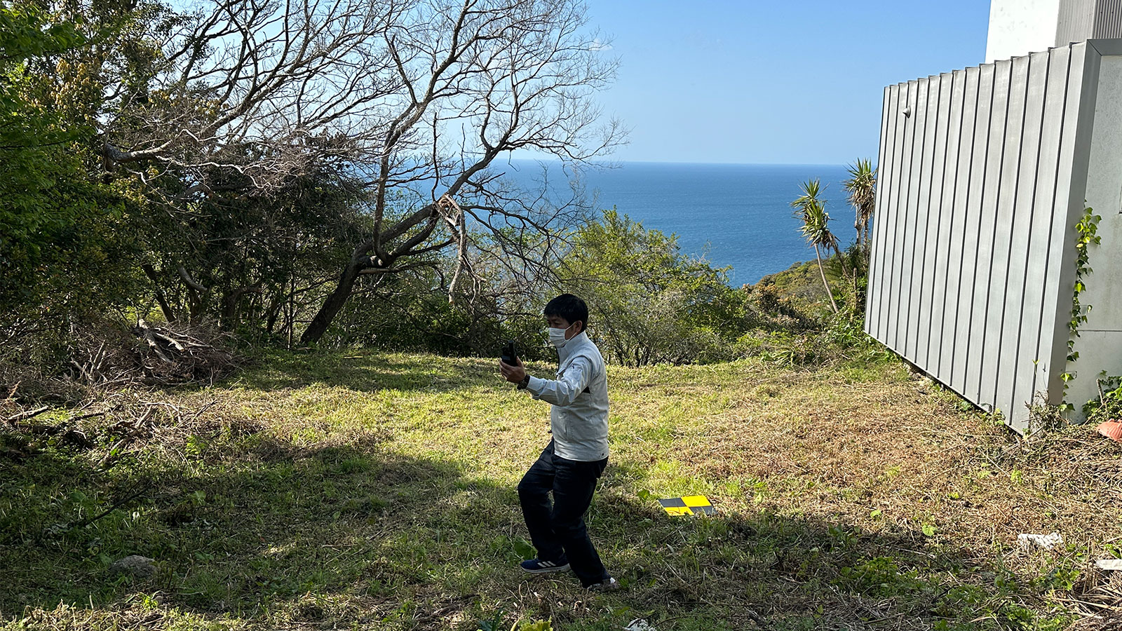
Kouken Geosystem Service employed both terrestrial and aerial photogrammetry, using a combination of smartphones and a drone. To gain further insights into the project, we conducted interviews with Mr. Ide, the CEO of Rhythm Design, as well as Mr. Yamashita, the CEO of Kouken Geosystem Service.
What were the challenges you faced?
Mr. Ide (Rhythm Design): Our challenge was to learn in detail about the topography of the mountainous terrain in Itoshima City, Fukuoka Prefecture, where the construction design site was located.
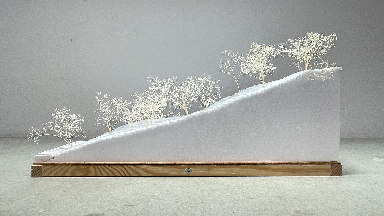
The mountainous terrain with its slopes makes it difficult to construct foundation structures and expensive to transport equipment. Therefore, our goal was to understand the shape of the land well so that we could design a foundation structure that minimized the need for foundation structures and facilitated construction.
In addition, under our motto of "making the most of what we have and creating what we don't have," we emphasize the importance of giving the impression that the construction blends in with the surrounding environment. An accurate understanding of the existing conditions was essential in order to design a structure that would make the most of the trees and landforms present on the site and minimize its impact on the surrounding environment.
In the past, we had Kouken Geosystem Service create a 3D model of the site using the PIX4Dcatch RTK workflow and were impressed by the high degree of reproducibility. That is why we asked them to do the modeling using PIX4Dcatch RTK again this time.
How did you use the PIX4Dcatch RTK workflow, combined with PIX4Dmatic?
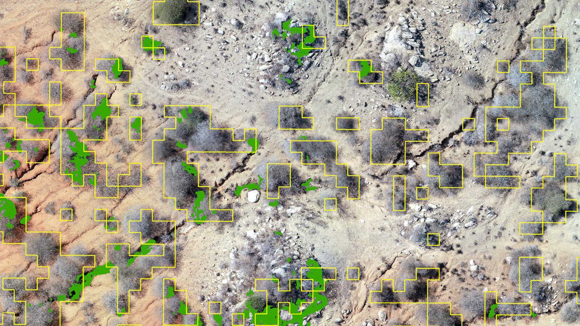
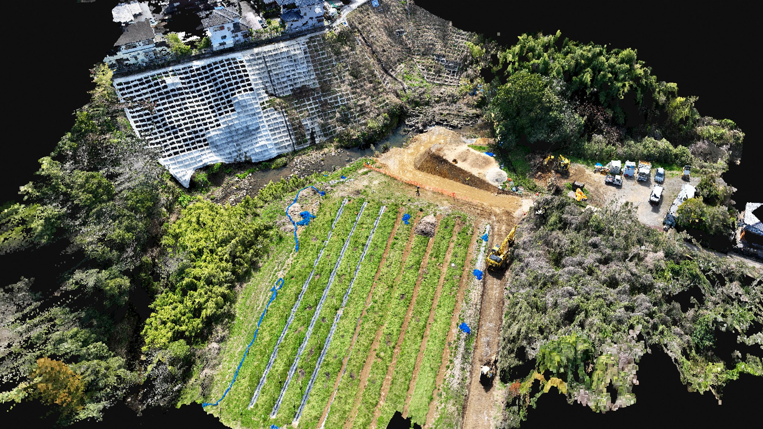
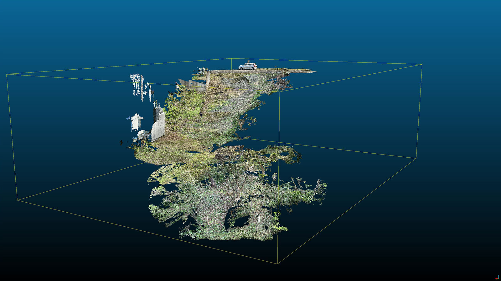
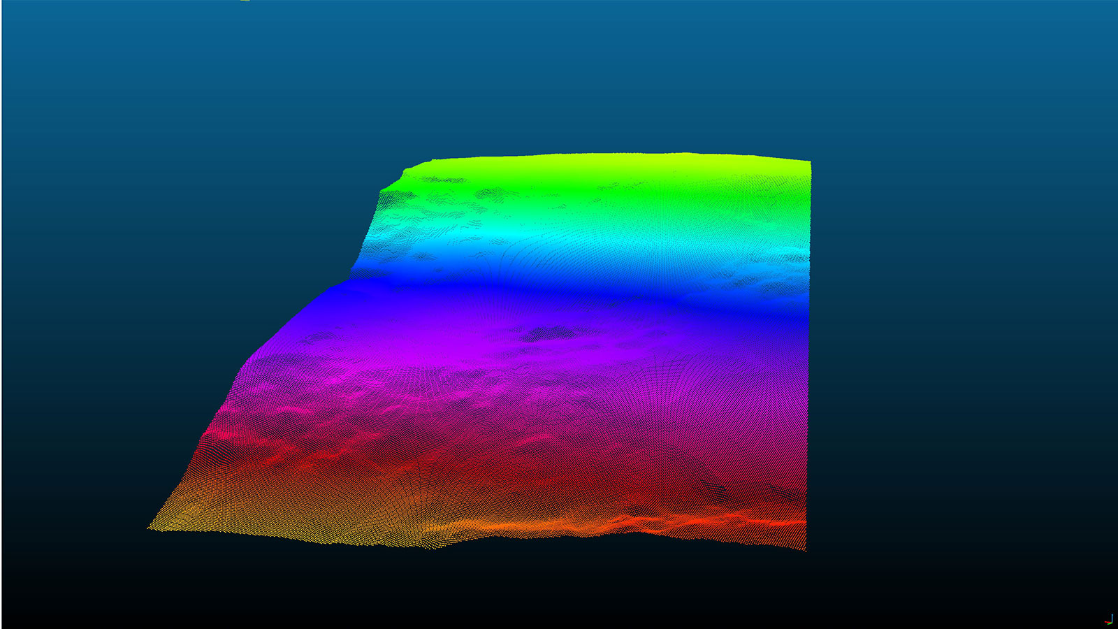
Mr. Yamashita (Kouken Geosystem Service): After receiving Mr. Ide's request, we first photographed the entire site with a drone and then used the PIX4Dcatch RTK workflow to capture data in areas with thick trees, etc. Since the PIX4Dcatch RTK workflow can easily acquire data in areas that are not visible from the sky, we were able to obtain data in dense areas with trees and areas that had not been cleared. We knew that even if there were some areas where RTK could not be fixed, the data could be processed without any problem, so we scanned while going under the trees and so on.
The positioning of the verification and marking points was acquired using single point measurement, a function of the PIX4Dcatch RTK workflow, and surveying equipment, such as a total station (TS) or GNSS rover, was not used.
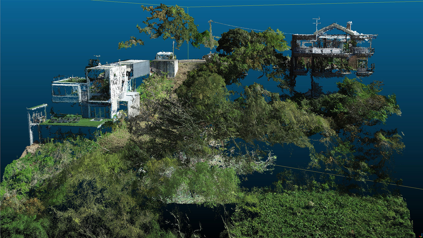
For processing the data obtained by the drone, we used PIX4Dmapper, which we have been using for a long time and are familiar with. For processing the data collected on the ground, we chose PIX4Dmatic. We then used PIX4Dmatic to combine the aerial photography data with the ground data to generate 3D point clouds, orthomosaic images, and contour planes.
We then used our proprietary software to create drawings based on these data, extracting only the ground surface, and delivered them together with the PIX4Dmatic output.
What were the results?
Mr. Ide: We created a model of the terrain from the data provided by Mr. Yamashita and used it to examine the architectural design. Normally, it is difficult to get an overall picture of the site at the design stage because the vegetation at the site has not yet been cut down, but the availability of highly accurate topographical data allowed us to design the site with a thorough knowledge of the topography. We were also able to identify trees that did not need to be cut down, and we were able to achieve our initial goal of minimizing the impact on the surrounding environment. When we posted about this use of topographic data on Twitter, we got asked questions from our peers. We feel that PIX4Dcatch RTK and Pix4D software are in considerable demand in the architectural design industry.
Project details:
| Location | Itoshima City, Japan |
| User | Kouken Geosystem Service Inc. |
| Area surveyed | 2000㎡ |
| Number of images | Ground photogrammetry: 400, Aerial photogrammetry:230 |
| Software used | PIX4Dcatch RTK PIX4Dmatic |
| Hardware used | Phantom4 Pro |
| Processing hardware | MOUSE DAIV 4P, CPU: Core(TM) i9-12900H, Graphics: Iris® Xe graphics, RAM: 64GB |
Why did you decide to use the PIX4Dcatch RTK workflow?
Mr. Yamashita: We originally decided to install PIX4Dcatch RTK because of its high work efficiency and portability in the field. The PIX4Dcatch RTK workflow can be used while walking around with it in one's hand.
Although other companies' products were also considered, we chose Pix4D's product because of its ability to collect data independently through single-point measurement, its high GCP recognition rate on the image, and its high accuracy in reproducing edges and other features compared to LiDAR solutions. The purchase was made through Pix4D's distributor, Image One Inc.
After introducing the system, we realized that the efficiency of preparation and photography has dramatically improved.