
Absolute Accuracy, Anywhere You Go
Unlock the full potential of your PIX4Dcatch projects with RTK


What is RTK?
Real-Time Kinematic (RTK) is a GPS technology that enhances positioning accuracy from meters to centimeters by correcting GPS signals in real time.
RTK applications by industry
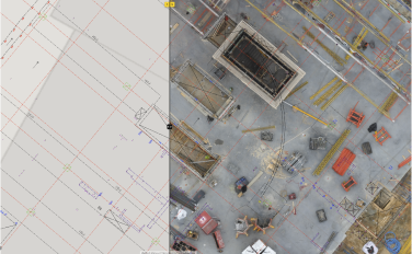
Surveying and mapping
RTK boosts mapping precision, enabling the creation of detailed and georeferenced 3D models and maps
Construction
Ensures projects match designs with exact alignment and positioning, facilitating seamless execution.
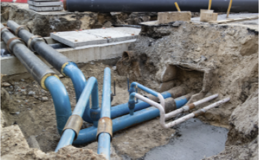
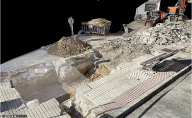
Subsurface utilities
Accurately locate underground utilities, preventing costly mistakes during excavation.
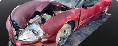
Forensics & public safety
Enhances CSI analysis and accident reconstruction with precise and court-ready evidence.
Excavation & groundworks
Accurate volume calculations, extraction planning and improved efficiency for mining operations.
How does Pix4D leverage RTK technology?

Precision and efficiency in data collection
PIX4Dcatch with RTK delivers centimeter-level 3D accuracy by using real-time geolocation, enhancing model precision and speeding up data capture while ensuring absolute accuracy.

Enhanced georeferencing
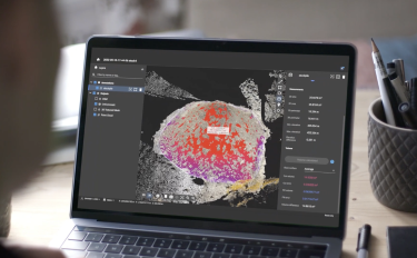
RTK greatly enhances PIX4Dmatic's accuracy, ensuring high-precision georeferencing essential for achieving absolute accuracy in project deliverables.

Easily process and share your data
RTK enhances PIX4Dcloud's accuracy, providing precise georeferenced data access for stakeholder analysis. It also improves DXF and IFC visualization with AR, offering accurate as-built previews in real time.
Compatible RTK devices

Emlid Reach RX*
- Weight: 250 g
- Size: 172 mm x 51 mm x 51 mm
- Temperature range: -20 to +65 °C (-4 to 149 °F)
- IP rating: IP68 (dust proof, water proof)
- Battery: (5200mAh) 16 hours of work
- RTK precision:
- Horizontal: 7 mm + 1 ppm
- Vertical: 14 mm + 1 ppm
- Signal tracking:
- GPS: L1C/A, L2C
- QZSS: L1C/A, L2C
- GLONASS: L1OF, L2OF
- BeiDou: B1I, B2I
- Galileo: E1-B/C, E5b
- Data protocols: NTRIP, RTCM 3.3, VRS
- Position output: NMEA
*Emlid Reach RX is not yet available for purchase in Taiwan and Japan through Pix4D.

Pix4D-adapted viDoc*
- Weight: 250 g
- Size: 153 mm x 72 x 19mm
- Temperature range: –5 up to +35 °C (23 up to 95 ºF)
- Battery: (4800mAh) 8 hours of work
- RTK precision:
- Horizontal: 1 cm + 1 ppm
- Vertical: 2 cm + 1 ppm
- Signal tracking:
- GPS: L1C/A, L2C
- GLONASS: L1OF, L2OF, QZ
- BeiDou: B1I, B2I
- Galileo: E1-B/C, E5b
- Special feature: Measuring laser
- Data protocols: NTRIP, RTCM 3.2, VRS
- Position output: NMEA
*Only Pix4D-adapted viDocs are compatible with PIX4Dcatch

Trimble® Catalyst™
Da2
- Weight: 330 g
- Size: (Diameter x Depth) 128 x 55 mm
- Temperature range: -20 to +65 °C (-4 to 149 °F)
- IP rating: IP65 (dust proof, rain proof)
- Battery: Powerbank (sold separately)
- RTK precision:
- Horizontal: 1 cm + 1 ppm
- Vertical: 2 cm + 1 ppm
- Signal tracking:
- GPS: L1C/A, L2C, L5
- GLONASS: L1C/A, L2C/A
- SBAS: L1C/A, L2C, L5
- BeiDou: B1L, B1C, B2A
- Galileo: E1, E5A
- QZSS: L1C/A, L2C, L5
- NavIC (IRNSS): L
- Data protocols:
- NTRIP, VRS, RTCM 3.2 MSM, CMRx, DCOL
- NMEA (LLH), DCOL
Coming soon

Bad Elf
Flex®
- Weight: 854 g
- Size: 254mm x 70mm
- Temperature range: -20 to +55 °C (-4 to 131 °F)
- IP rating: IP65
- Battery: (12000mAh) up to 11h
- RTK precision: Horizontal: 8 mm + 1 ppm
- Signal tracking:
- GPS: L1CA, L1P, L1C, L2P, L2C, L5
- GLONASS: G1/G2/G3, P code (P1/P2)
- SBAS: L1C/A, L2C, L5
- BeiDou: B1i, B2i, B3i, B10C, B2A, B2B, ACEBOC
- Galileo: E1BC, E5a, E5b, E6BC, ALTBOC
- QZSS: L1CA, L2C, L5, L1C, LEX
- NavIC (IRNSS): L5
- Data protocols: Hemisphere GNSS’ ROX, RTCM v2.3 (DGPS), RTCMv3 (RTK), CMR, CMR+, Atlas
Learn how RTK helped our users
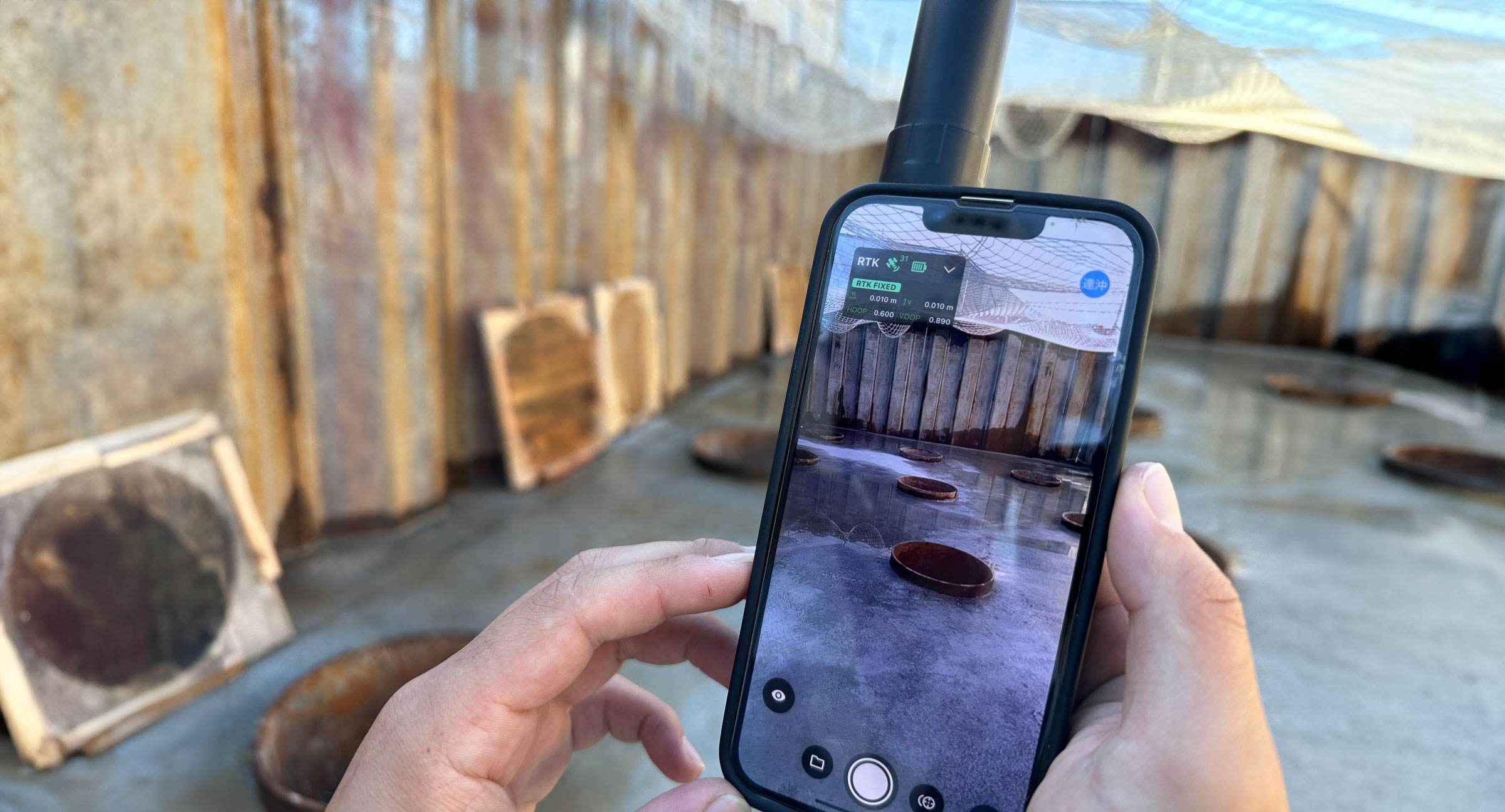
PIX4Dcatch application: from field survey to as-built
In our interview with CRAFTCOM Co. Ltd we discuss the integration, use, and impact that PIX4Dcatch with RTK had on their workflow.
Learn more >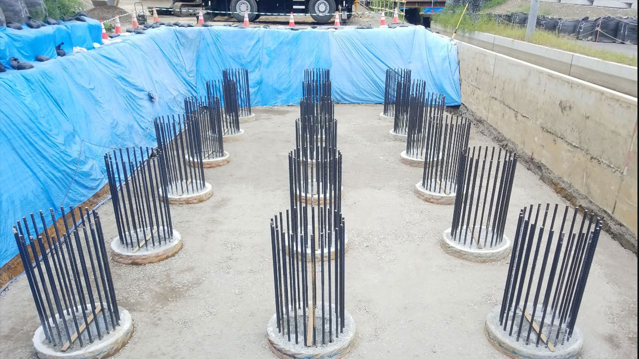
Inspecting an as-built bridge abutment with PIX4Dcatch
How accurate is PIX4Dcatch as a mobile 3D measurement technology for quality control? Is it more efficient than conventional methods?
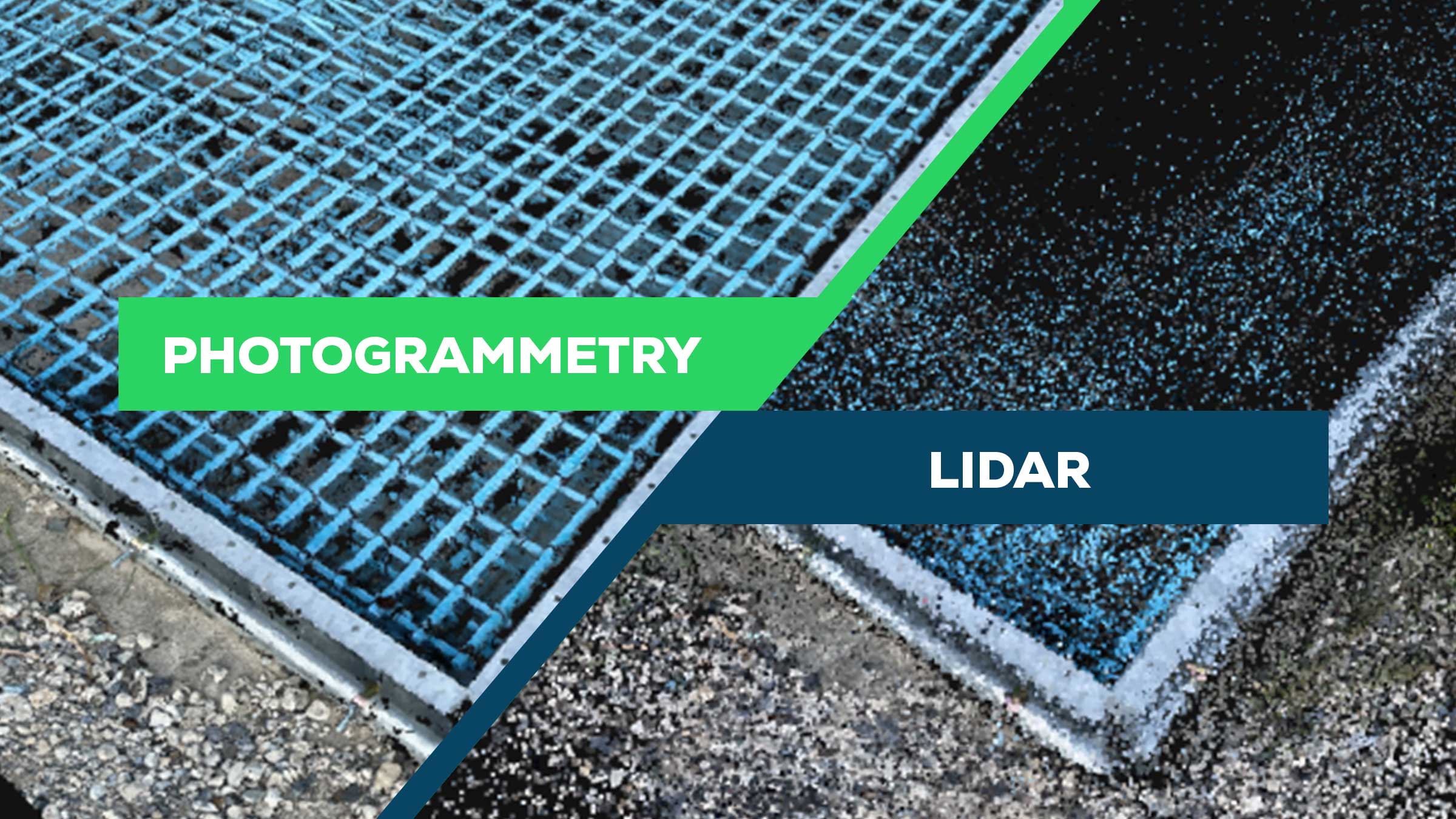
Point cloud comparison: photogrammetry vs LiDAR
We investigated the benefits of photogrammetry versus LiDAR for generating 3D point clouds.
Learn more >Learn how RTK helped our users
