
PIX4Dmatic 1.39: share to PIX4Dcloud and new mesh exports!
PIX4Dmatic is the ideal solution for fast and accurate terrestrial, corridor, and large scale mapping. It is rapidly evolving to offer the most essential functionalities for professionals, PIX4Dmatic now introduces a smooth workflow for sharing to PIX4Dcloud - a feature specifically requested by our users.
In addition to the .obj file format currently supported, you can now export 3D meshes in Cesium 3D tiles and .slpk file format, and also have all of your data captured in a custom coordinate system with site localization support. Lastly, there are great improvements to the visualization and navigation, new cameras, and a new geoid. Keep reading to learn more!
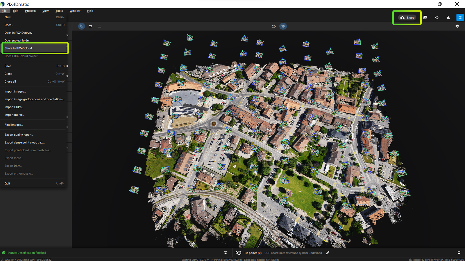
Share to PIX4Dcloud!
Sharing to PIX4Dcloud has always been one of the most valuable workflows for many of our users and it is now available in PIX4Dmatic. With this brand new feature, you can easily upload outputs such as point clouds, DSMs or orthomosaics to PIX4Dcloud and share it with colleagues and clients all over the world with one web link. Leverage the integration of our products and make the most of our secure cloud in order to facilitate the communication between teams and workplaces. The workflow for sharing to PIX4Dcloud is very easy and intuitive. You can either upload your outputs through the file drop down menu or use the “Share” button in the processing panel to get quick access to the Share to PIX4Dcloud functionality. Choose whether you share a link for viewing or editing and maintain full control over the processing progress through the status center. Find out more in our support article. (Included in your PIX4Dmatic license are 12 projects for perpetual and yearly licenses and 1 project for monthly licenses and trials - make sure you try it out!)
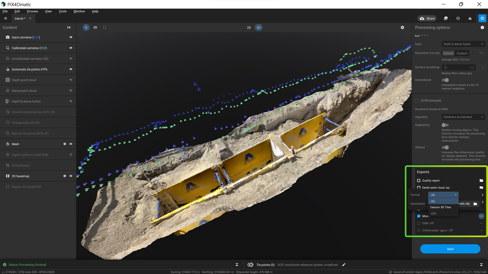
More mesh exports for more applications!
3D meshes are a valuable tool for reconstructing reality as they can provide accurate and realistic information about the real world. In Pix4D we are constantly working on improving the quality of the 3D mesh in terms of geometry and texture as well as expanding PIX4Dmatic’s capabilities in supporting your workflows, including a mesh viewer and now we have added more export options that let you work on more projects and applications.
In PIX4Dmatic 1.39 we have added Cesium 3D tiles exports (in .b3dm and .json format) in order to get different levels of detail and expand the choices of third party viewers to display your 3D textured mesh. In addition, PIX4Dmatic supports compatibility with ESRI as the mesh can also be exported to an .slpk file. Finally, for our Revit users, you can now better model and leverage the data of a 3D mesh as PIX4Dmatic is capable of exporting a dense, full point cloud from a 3D mesh in .laz file. Read more on how you can generate a 3D mesh.
All your measurements in your local coordinate system!
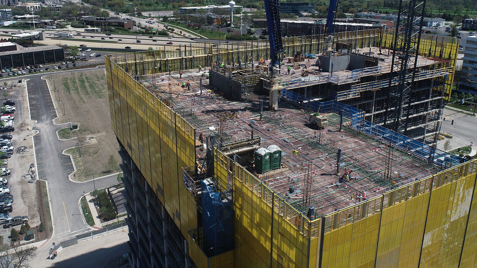
Surveying a big site like a construction or a mining one is a challenge.
The size of such projects introduces a lot of complexity as measurements of different objects most of the time can not be done with the same coordinate system. The reasons for this may vary: teams may not be measuring with the same equipment, different accuracies are required depending on the object, or the need for fast and effective work on the field imposes the use of an arbitrary coordinate system defined on the spot. However, in most cases, the processing and the final deliverables should be in a common coordinate system that helps interdisciplinary work and homogeneity of the data provided, through a site localization process.
With the latest release, PIX4Dmatic now supports site localization functionality: you can measure different areas of your site with various coordinate systems and accuracy requirements and create deliverables for each of these areas in PIX4Dmatic. This can be done easily with the import of a .wkt file created with PIX4Dcatch or a .prj file which allows you to set your custom coordinate system.
Further improvements!
PIX4Dmatic provides a complete terrestrial workflow: capture LiDAR and RGB images with our free application PIX4Dcatch, accurately geolocate the images with the viDoc RTK rover and generate accurate 3D models with no loss in data. In order to make this workflow even more effective and easy to use, we are constantly optimizing every step of the process. With this release, you can now enjoy improved navigation in 3D view, more intuitive camera manipulation and an overall better experience especially for PIX4Dcatch data collection and oblique images. Finally, PIX4Dmatic now has support for Geoid system from Norway (Svalbard) - adding to the extensive list already available and cataloged on the Pix4D Support site. Additionally, three new cameras were added to the precalibrated camera models database for better support:
PIX4Dmatic is getting richer in features and functionalities, enabling you to improve your photogrammetry workflows. If you want to learn more, download the new version now to try what is new for yourself, visit our support site to watch our new video tutorials and check out our free webinar on combining aerial and terrestrial mapping and our online workshops. Get inspired by the way people from around the world use PIX4Dmatic and make sure not to miss the current Geospatial Offer for current PIX4Dmapper users. Stay tuned!


