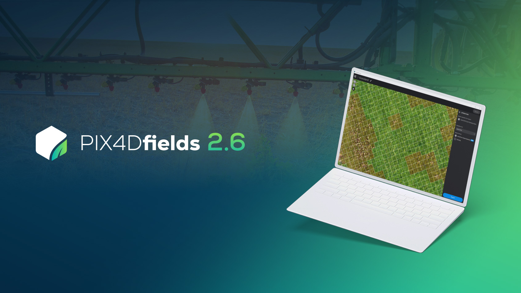
Enhance your agriculture workflow with Pix4Dfields
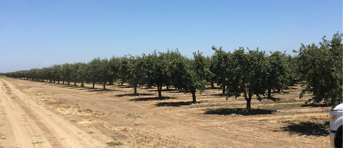
California cash crop
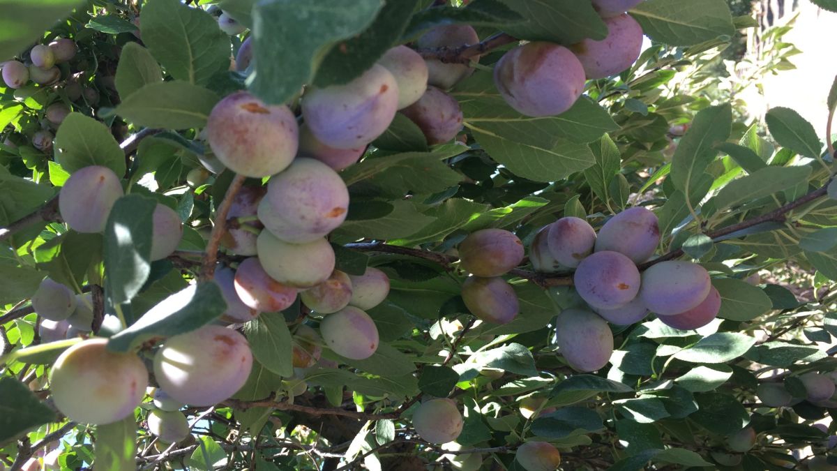
Prunes are European plums with a high sugar content that allows them to dry without fermenting around the pit and are almost all marketed dried, as prunes or dried plums. California produces 96% of the prunes grown in the US and around half of California’s prunes are consumed domestically and half exported.
One of Pix4Dfields’ early adopters: Pinpoint Aerial Solutions (PAS) invited us to visit a prune farm in Yuba City, and see how the team uses Pix4Dfields. Nestled in the fertile Sacramento Valley, Yuba City is in the heart of the dominant prune-growing area in California. Since the 1960s, more than 80% of the state’s crop has come from the Sacramento Valley area.
Pix4Dfields was built with the input of farmers and agronomists like the team at Magenheimer Farms, and we were excited to take the perfect opportunity to speak to our users about their software requirements and learn how Pix4Dfields is integrated into their workflow.
Yuba City-based PAS work as service providers, utilizing multi-spectral cameras to analyze crop health. Part of their role as service providers is assisting farmers or agriculture advisers in crucial management decisions.
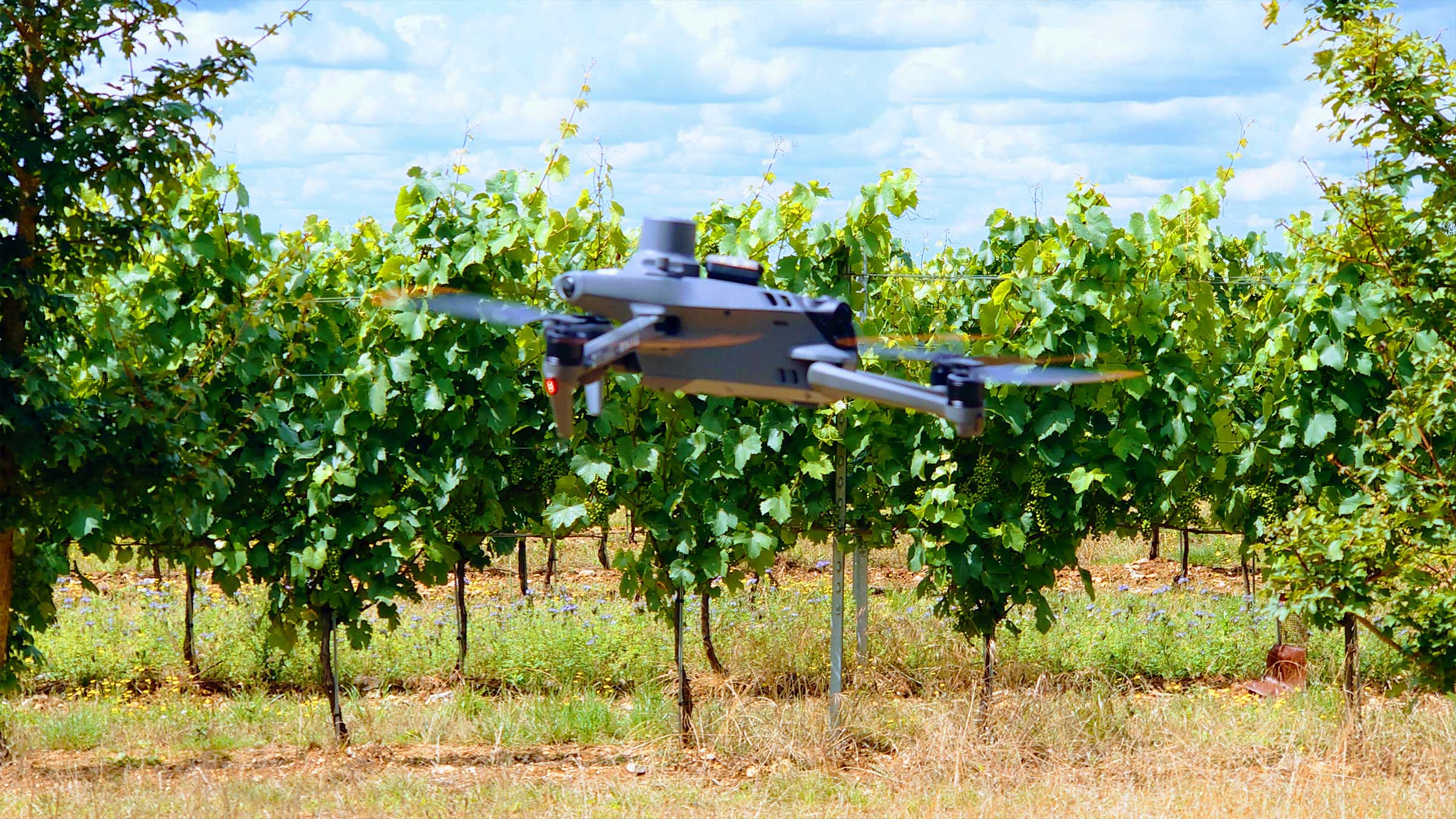
Crop scouting with a drone
Among 31 acres of prune trees, Nicholaus the owner of PAS, and Alec the manager of the farm, shared more about the project: helping the farmer predict the overall tree health after the last foliar nitrogen application.
Foliar fertilization involves applying nutrients to plant leaves, rather than the root system, which allows growers to respond in a more precise and immediate way. This particular application was extremely important because it was the last one before the harvest, giving the fruit a final boost.
PAS used the DJI Matrice 600 Pro with a MicaSense RedEdge-M to capture the data. The drone was flown at 110 meters at 8 m/s with a 80% overlap.
We want to give a big shoutout to both MicaSense and DJI – both the drone and the camera worked great in temperatures over 40°C (100°F)!
After the 20 minute flight, 2,771 image were collected which ended up being around 6.35GB of data.
The ten minute crop protection assessment
Once the data was captured, it was transferred from the drone’s SD card to a computer in the PAS truck.
All 2,771 images were processed on-site using Pix4Dfields in less than ten minutes. Ahead of processing, Pix4Dfields offers Advanced processing settings where you can specify the weather conditions whilst data capture or specify the desired Ground Sample Distance (GSD).
After the processing was complete, Nicholaus demonstrated how he uses Pix4Dfields features on the newly collected data.
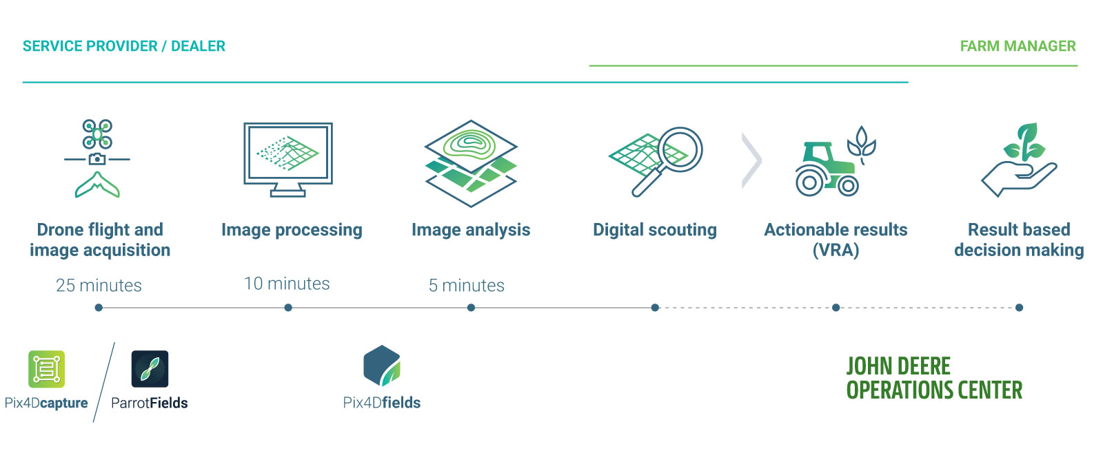
- Fly the drone and collect the data
- Generate the orthomosaic.
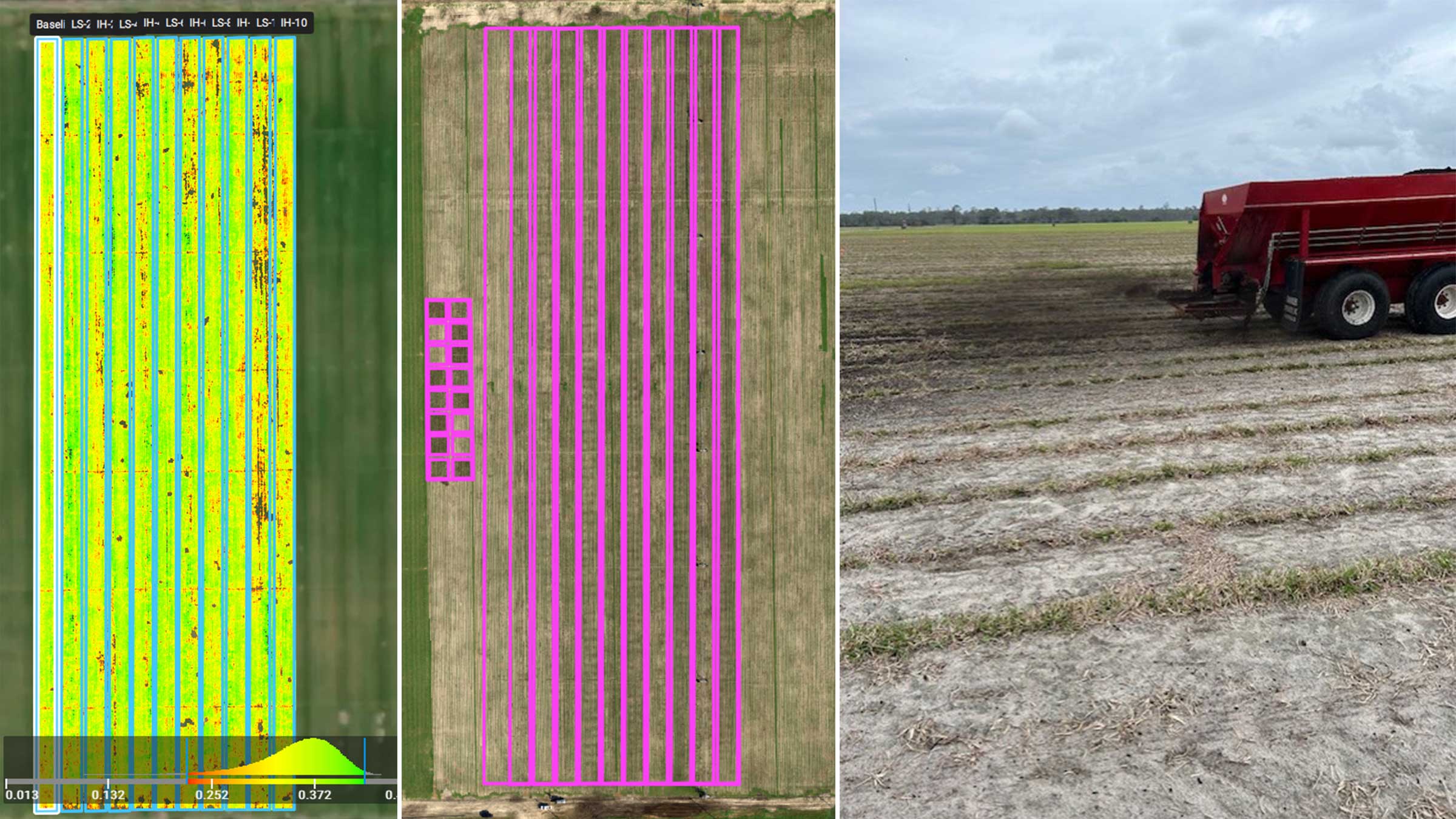
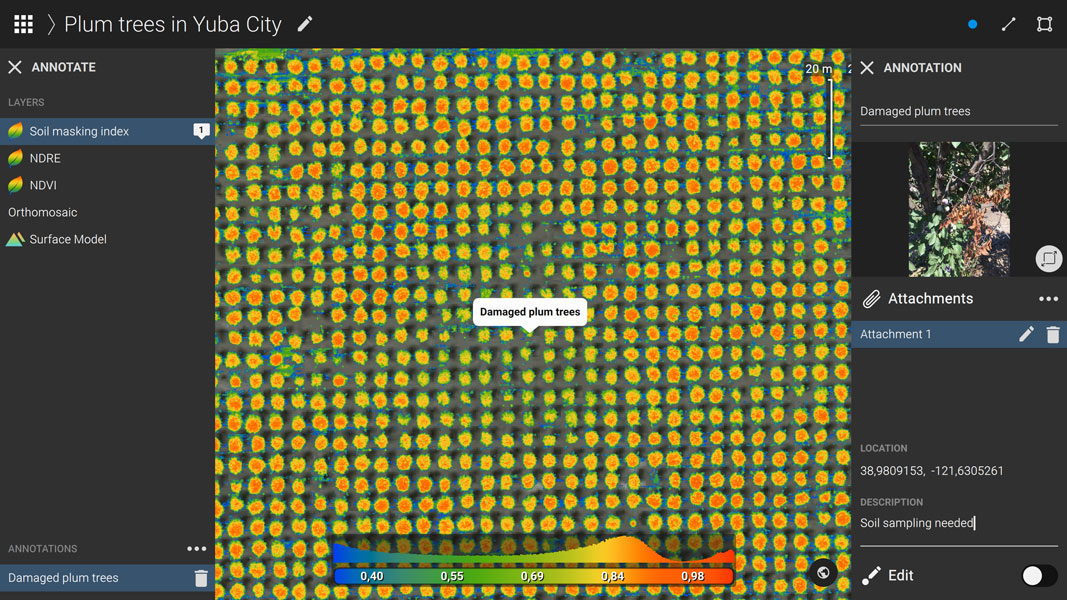
- Generate predefined index maps (NDVI & NDRE) as well as create a custom index map masking out the soil
- Use the comparison tool with the orthomosaic and the custom index to do a quick comparison of the field
- Use the zonation to create an “easy to read” map of the problems areas which he then focuses on
- Use annotations to highlight the ‘focus areas’ and adds more information to them
- Export the PDF report and share it with the client
- Connect to the John Deere Operations Center
Having the Pix4Dfields image processing done in less than ten minutes, PAS was enabled to do the image analysis on-site, discuss the results and immediately scout the focus areas with the Farm Manager. Export options like the PDF report - add the possibility of sharing the results with your clients or other team members. By connecting to the John Deere OC - allows users to further utilize data and visualize it next to the other layers of information (yield maps, soil maps) to make even more informed decisions.
Crop protection analysis
With the help of the custom index map and the annotation tool, Nicholaus highlighted potential issue areas to the Farm Manager on site.
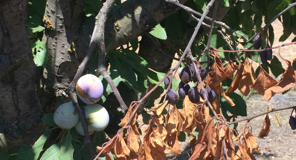
Once we arrived at the identified area we confirmed the results from the data; around 28 trees were growing less densely than their neighbors. The farmer immediately began the process of gathering soil and leaf samples to figure out what exactly is causing the issue.
With the help of the Pix4Dfields instant processing and analysis tools, PAS enabled the Farm Manager to make the timely and focused decisions on site as a part of their every day workflow.
Each tree matters
Prunes from this farm are tunnel dried ahead of packaging and are sold per ton per acre. Depending on the sugar quantity and fruit quality the price varies from 1,300USD up to 2,000USD per ton with an expected yield of three tons per acre. In other words, each tree matters and having stable tools that produce accurate and fast results brings immediate value through enhancing agriculture workflows.
Pix4Dfields enables the Service providers like PAS to do their jobs in a faster and more accurate manner while at the same time providing Farm Managers with actionable data in the field. Pix4Dfields has a direct impact on farm management – and consequently on farm’s profit.
Special thanks
| Special thank you to Pinpoint Aerial Solutions for sharing their story and workflow with us. |