
Surveying 10,500 hectares with a drone and PIX4Dmatic
One of the major benefits of drone mapping is that you can use it to access and survey remote areas. Even if there is minimal infrastructure, certain drones can fly large areas and gather data. This is particularly useful for engineers planning new road or pipeline installations. The scale of land they need to survey to plan new highways is immense, whilst driving to it may not be an option. Aerial solutions with a drone are an ideal solution to this challenge.
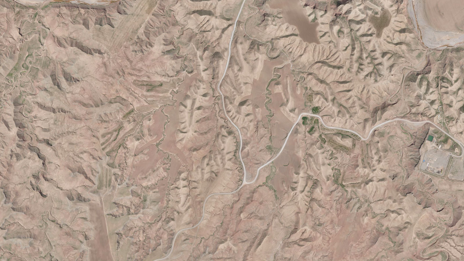
GeoDesign Company, based in Sulaimaniyah, Kurdistan-Iraq, is a surveying and highway engineering company. Ako Shwan of GeoDesign has been working in surveying and motorway design for 20 years. The typical projects he works on include producing orthomosaics to use for simulating roadway plans. He normally uses PIX4Dmatic for these projects as he is often working on large scale projects with datasets over 5,000 images. PIX4Dmatic is designed to handle large projects for corridor mapping or analyzing big areas as well as terrestrial projects. For a recent project, Ako was contracted to survey 10,500 hectares and produce an orthomosaic and digital terrain model (DTM). He used PIX4Dmatic for the project.
Project details
| Location | Sulaimaniyah, Iraq |
| User | GeoDesign Company |
| Area surveyed | 10,500 hectares |
| Images captured | 18,000 |
| Software | PIX4Dmatic PIX4Dmapper |
| Hardware | WingtraOne 42 megapixel camera |
| Processing time | 3 day turnaround |
| Processing hardware | AMD Ryzen Treadripper 3960 24 core CPU 128 GB RAM, Nvidia RTK 3060 GPU |
Mapping uneven terrain with drones
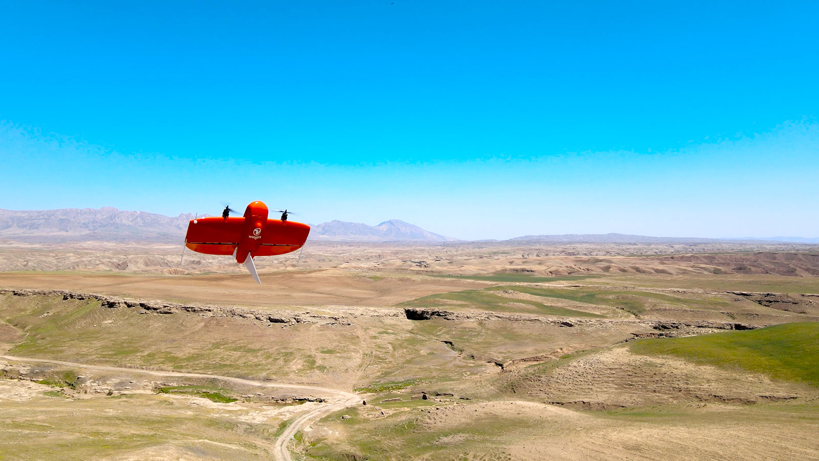
The area for this project was incredibly difficult to access. Ako travelled to the region in the winter, with the temperature not rising above 25 - 26 degrees Celsius (77 degrees Fahrenheit), making it possible to work outdoors. This would not an option in the summer as the heat would be unbearable. To begin, Ako used an offroad Polaris ranger to get to the target area. Once there, he deployed the fixed-wing WingtraOne drone with a 42 megapixel camera. Fixed-wing drones can fly for longer periods of time without requiring a change of battery. They can follow pre-set flight plans, which is useful for a large project such as this.
Data collection alone took 7 days. Ako had a 60 day project turnaround deadline, and knew that processing would require some time as well. Once back at his office, he transferred the data to PIX4Dmatic. To begin with, he processed imagery for 1,000 hectares and created an orthomosaic. PIX4Dmatic can handle over 10,000 image datasets so this was not a challenge for the desktop photogrammetry software. Once complete, Ako shared the resulting orthomosaic with his client. After they confirmed that it was exactly what they wanted, he began processing the other 9,500 hectares.
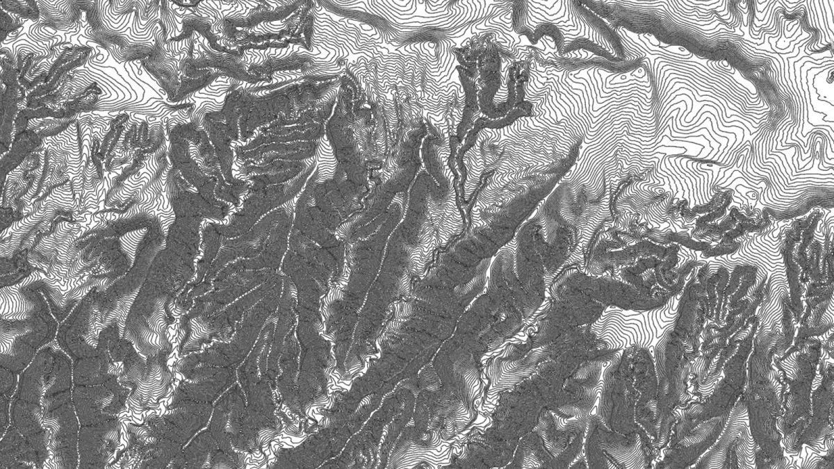
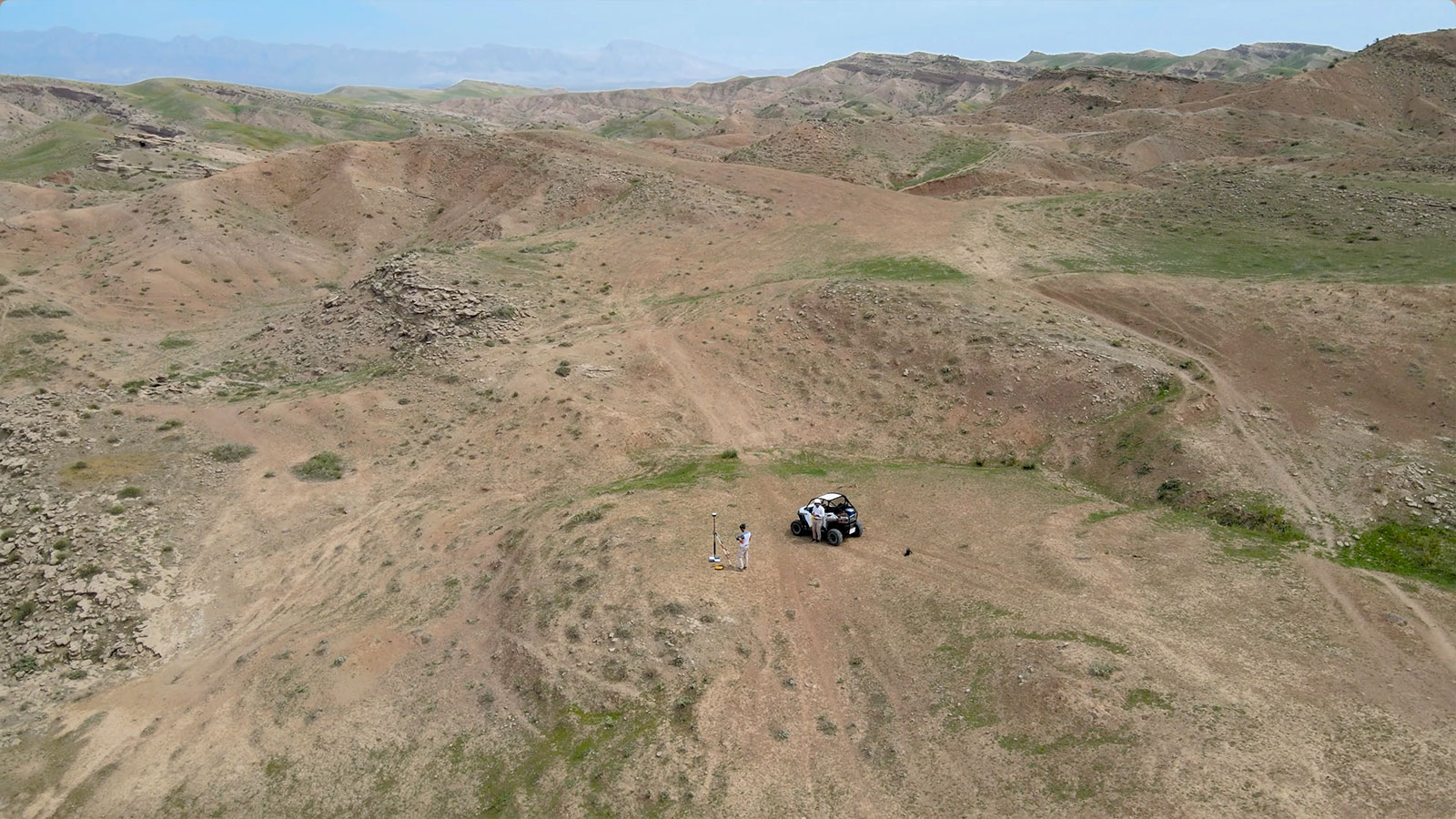
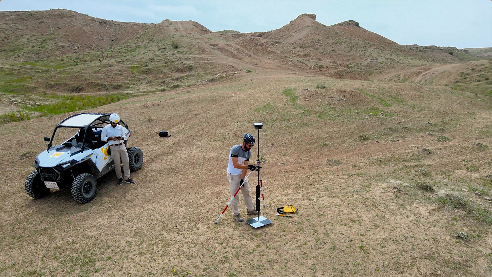
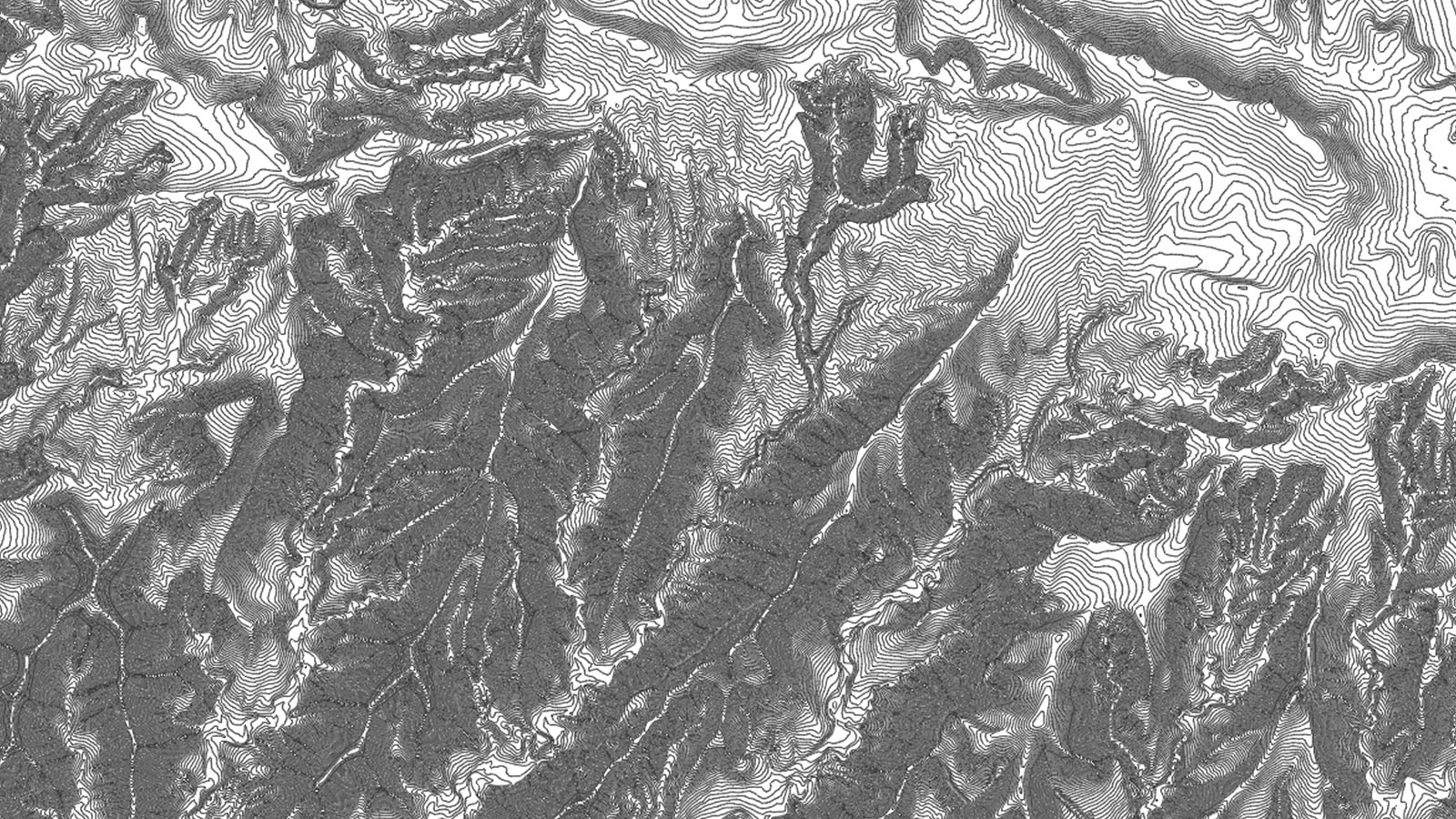
Processing took 3 days with PIX4Dmatic. The key outputs that Ako wanted were an orthomosaic and a digital surface model (DSM). These two deliverables would be shared with the client after his analysis was complete. He also generated Digital Terrain Models (DTMs) with PIX4Dmapper for smaller, specific areas to add to his outputs. Ako had set up Ground Control Points (GCPs) by driving across the terrain and manually placing and measuring them. Using these GCPs meant the DSM would be accurate, and he created the topography at 50 cm intervals and checked on-site by taking direct profiles via GNSS to make sure it matched reality. When the DTM and orthomosaic had been checked for accuracy, Ako shared his results with his client.
Why drone mapping is suitable for remote areas
Ako had to survey a place that had little to no road access. His work will be used for the creation of new roads and installations of pipelines and infrastructure. PIX4Dmatic has previously been used for remote surveys in areas with no infrastructure like the Amazon rainforest because the aerial view of a drone combined with photogrammetry gives access to previously inaccessible places. In the dry, topographically varied region Ako surveyed, drones were the best tool for the job. His accurate topographic map is being used to plan the best path for a new road network that will be the most straightforward to create.
"We used PIX4Dmatic because it is easy and simple to use. It can be used for large projects (more than 5000 images) and can quickly process large projects, with no need to breakdown the project into separate sections and stitching it together - it provides a unified, nice Orthomosaic." - Ako Shwan, Director at GeoDesign Company
The orthomosaic from PIX4Dmatic will be used to simulate plans and identify potential hazards to the construction process. Thanks to using aerial drone maps, the constructors and clients will be able to effectively plan their development. The project was so successful that the same client is willing to contract GeoDesign Company to survey a 15,000-hectare area to assist their development plans. They are pleased with Ako not only because of the quality of results but because he managed to complete the project in 50 days, rather than 60. The rapid turnaround was possible thanks to the fast processing by PIX4Dmatic, which helped Ako secure further business opportunities. There was a clear return on investment for using drone mapping for this project.
Ako’s large scale drone survey was an example of what is possible with specialized surveying equipment. Drone mapping is cheaper than satellite mapping and can pick up more detail. Despite the challenge of surveying a huge area, Ako produced reliable, accurate results for GeoDesign’s company that they can use for multiple new projects.


