Interview: how a firefighter is using drones in US cities
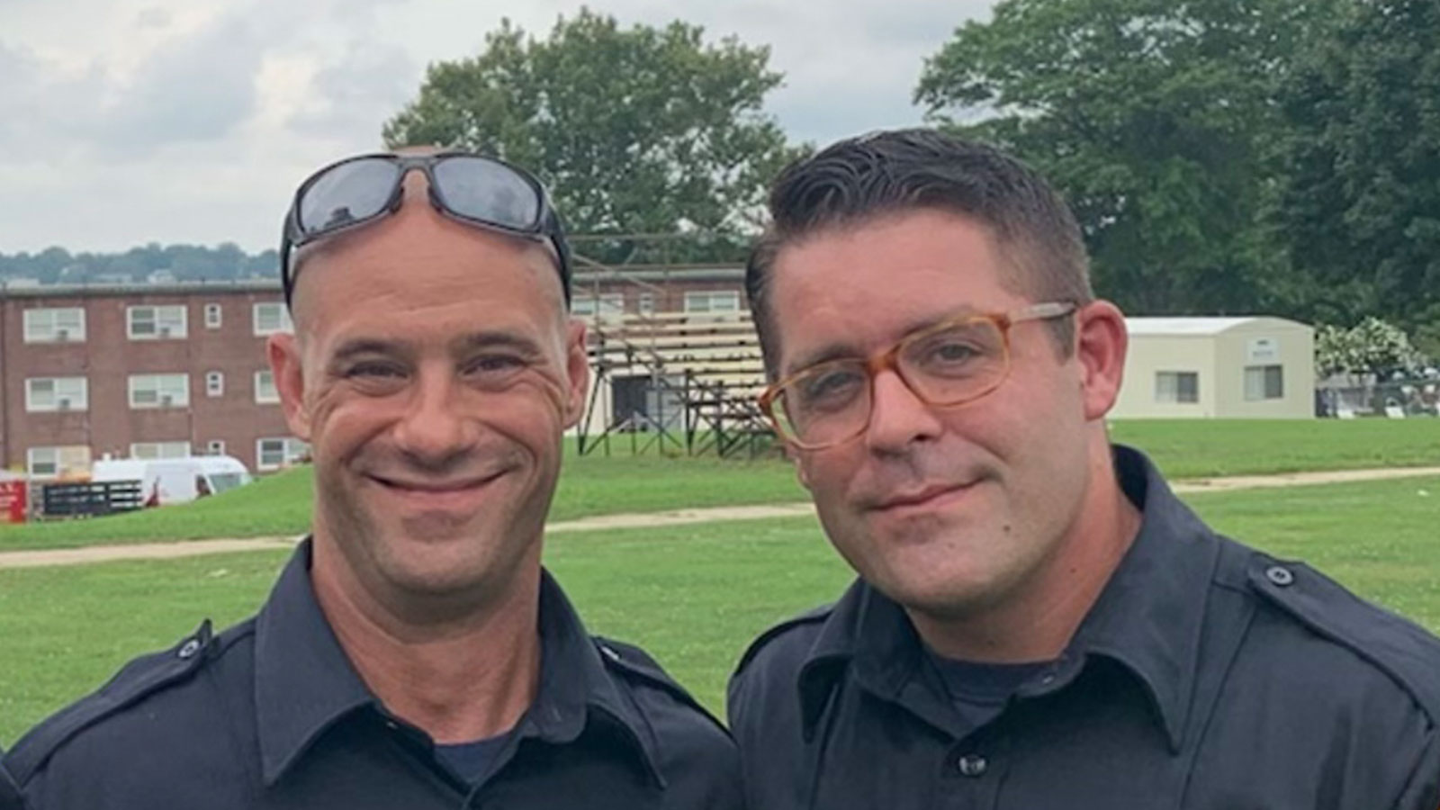
Pix4D interviewed firefighter John Wakie, who is an sUAS pilot and consultant. He’s been using drones to fight fires for 6 years in his work in the USA. John told us about his experiences with using drones, how he’s been integrating them into his department, and what he thinks the potential for them is.
Tell us about your work - How are you using drones for firefighting?
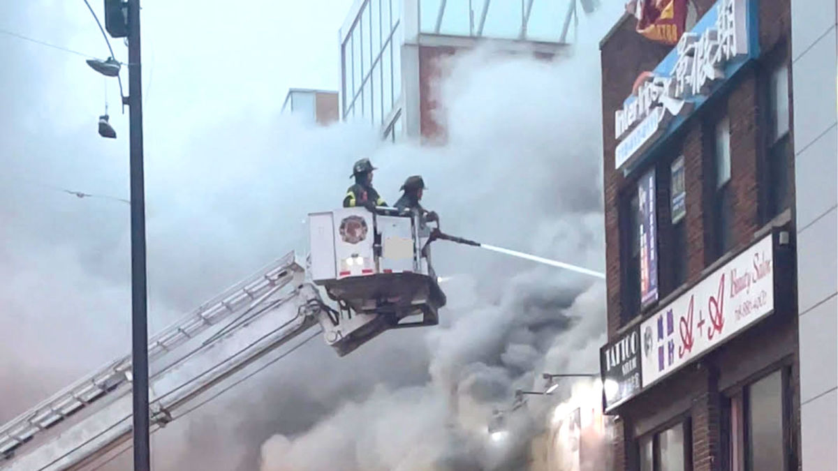
I’ve been a firefighter for 17 years, and right now I’m living and working in New York City. We work primarily in urban areas, so we are used to high pressure callouts that require fast responses and flexibility.
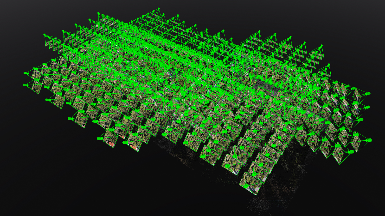
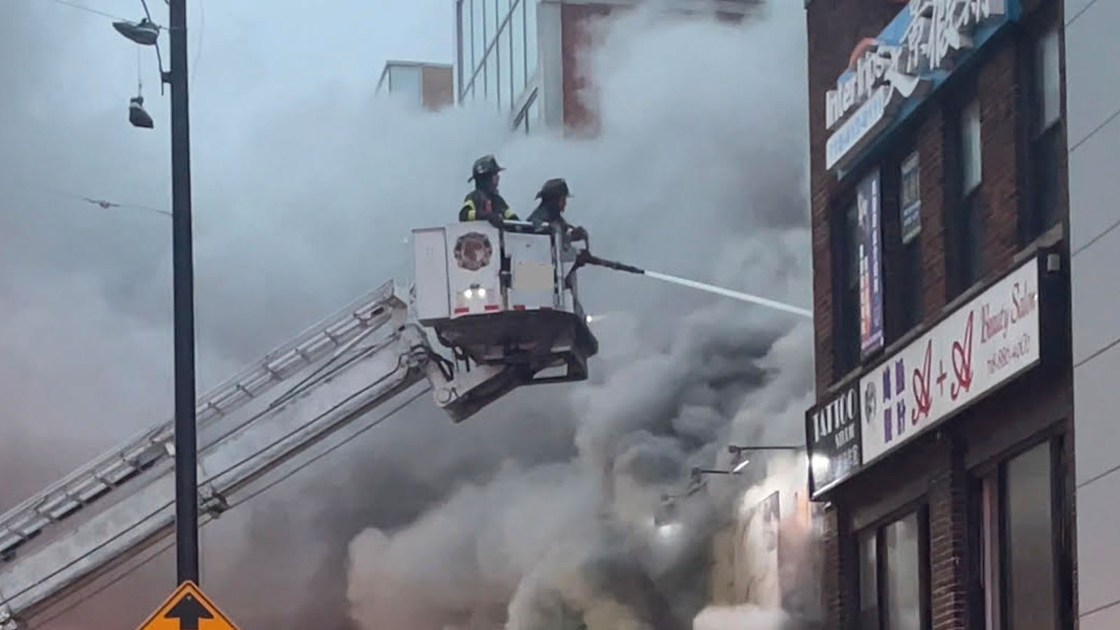
As part of that, I’ve been part of a drone unit that was first established 5 years ago. The drone unit assists firefighters from the air. Drones can monitor everything, and with fast mapping software like PIX4Dreact, they give situational awareness in live response scenarios. Alternatively, drone units can use thermal imagery but that can take longer to process and is only used for immediate situation monitoring.
Drones being used for firefighting in New York started in the aftermath of 9/11. My team started using drones because we wanted a new tool that could make a difference in firefighting without putting staff at risk.
What are the obstacles to starting a drone unit?
New York has very strictly controlled airspace - New York City has three major airports, seasonal Seaplane bases, as well as multiple heliports. That means in order to use drones in New York City the Fire Department has to have permission to operate drones in the complex airspace.
Most of the time we can complete our flights in line with the FAA facility maps that regulate air traffic. For the remaining 10% of incidents, we simply adapt our flight plans or have to file an SGI. Operators also always fly with manual controls rather than with automated flight plans. This allows the pilots to maintain complete control of the drone as our area of operations are always complex and evolving. We use flight automation only when mapping, or testing a specific system or workflow.
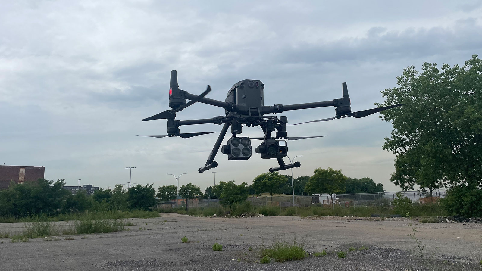
The next obstacle would be making sure you have the right equipment. For instance, US grant funding can only be used to purchase certain equipment. Our team relies on various multirotor drones that can be rapidly deployed.
Of course, when you’re an emergency responder, there will be things that go wrong. We work on identifying what has failed, and why - is it equipment, or is it something that the team needs to train for in the future? Our ability to react to and adapt to changes helps our success.
Finally, I’d say expanding the unit can be difficult. Colleagues are excited to join the unit and learn about the equipment. The experienced operators need to ensure the newcomers are adequately trained. Pilots undergo several evaluations before being “cleared” to operate any piece of equipment.
How are you using drones?
When we have a callout, we get to the site as fast as possible. We respond with our primary equipment which is a small multi rotor drone. There are great, larger models like the M-300, but they can take 2 or 3 operators, and we are focused on fast response times. We have used the Mavic 2 Advanced or Phantom 4 RTK for our work in the past but we’re exploring alternatives now. We are always testing new equipment, from various manufacturers. This allows us to not only choose the best sUAS for the specific mission, but allows the team the flexibility to be proficient in multiple sUAS models.
With post-processing/PPK, you can get the same accuracy if not better then RTK. This is ideal because it means if you’re using a non-RTK drone you can still get the same results without as-expensive hardware. Propeller Aeropoints are a great example of simple but effective PPK workflows.
Once we collect imagery around a scene, we push it through PIX4Dreact to get situational awareness and analyze the scene, before planning our response and resource deployment. We’re part of informing decisions and keeping our teams safe.
What software did you choose to process your imagery, and why?
We use photogrammetry software to process photos captured with the drone to create 2D or 3D outputs. We need to use desktop-based software instead of cloud options to maintain data security and have a clear chain of ownership of our images to be transparent for investigations or debriefs.
In the early days, we used PIX4Dmapper and just focused on getting the 2D orthoimages. We needed low-res and low-grade settings to get fast results, which could be done in 15 - 20 minutes. The benefit of PIX4Dmapper over other software was that outputs were georeferenced, which helped with site awareness. Then, when PIX4Dreact was released and specified for emergency response, we added that to our workflow.
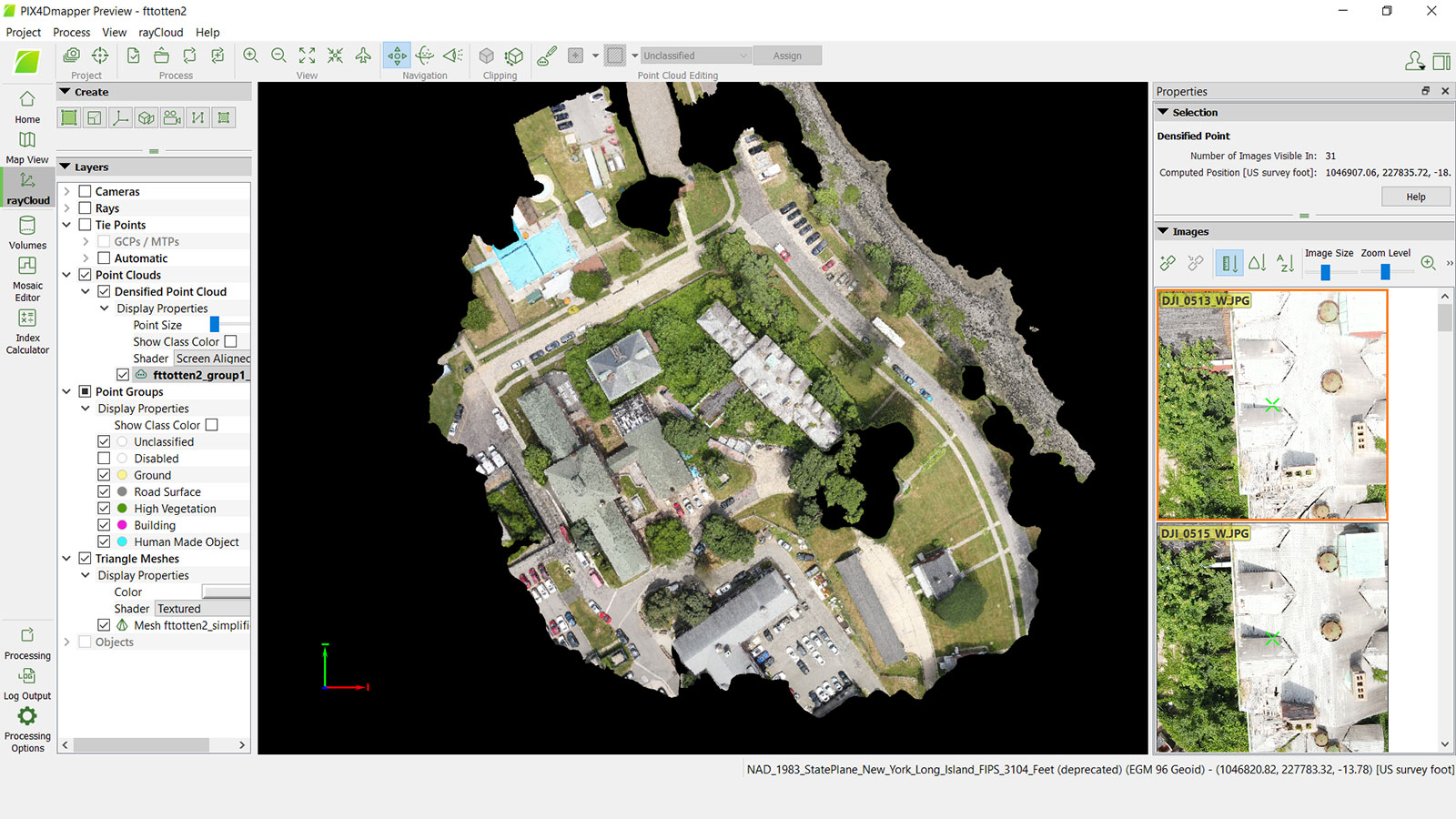
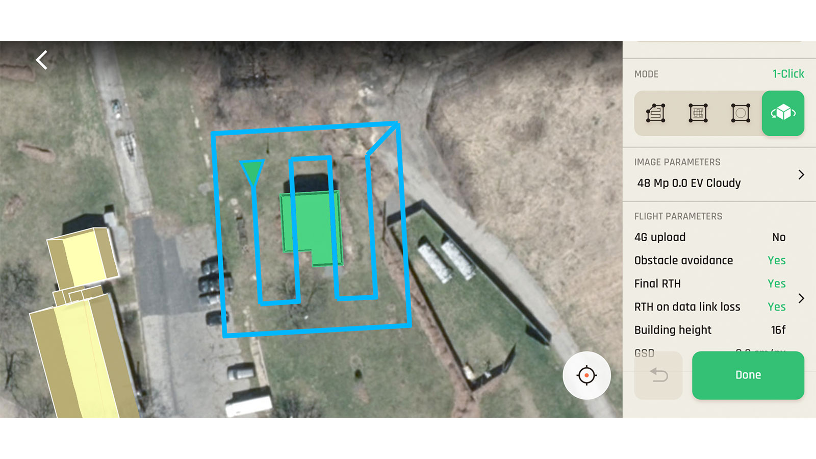
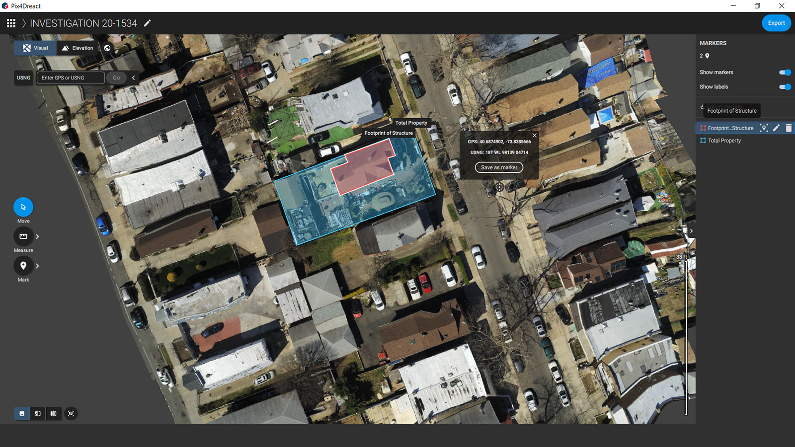
PIX4Dreact is the ideal solution for firefighting with drones. It is a desktop program and works faster than PIX4Dmapper for in-the-field work. We can use it in one of two ways. The first is for real-time situational awareness to allocate resources to a specific area. Alternatively, we can use PIX4Dreact for pre-planning on a site or event. Our work isn’t just about emergency response but also surveying event spaces to make sure everything is safe and up-to-standard. PIX4Dreact can be used by a single operator, which is where it shines. You can pop out a memory card, throw it into a computer, and within 15 minutes you’ll have a map you can use.
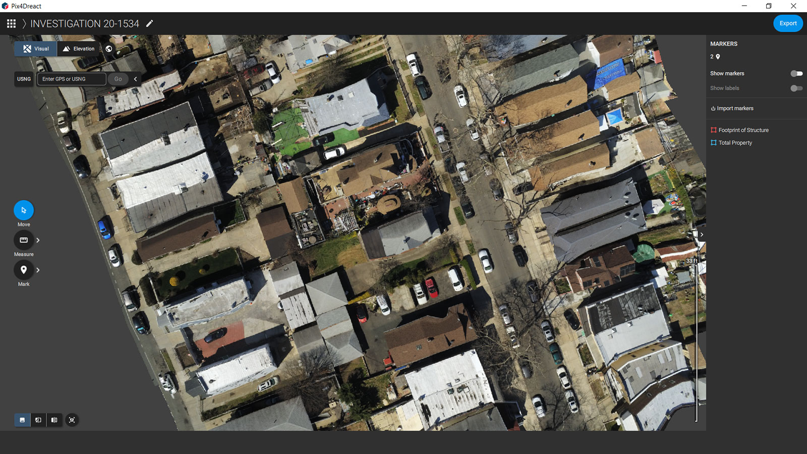
We use the results from PIX4Dreact as GeoTIFFs which can be shared and analyzed with ease. The offline processing is one of the major advantages of the software - we are annotating and exporting deliverables as fast as possible. It’s the best program we have used so far, bar none.
How has this made a difference to your work?
We are currently using drone data to plan our responses. Data allows for better understanding of the situation, and helps the Incident Commanders create efficient plans without compromising safety. We work with high pressure situations and it would be easy to rush through if we weren’t specially trained not to do so.
The speed of PIX4Dreact cannot be overstated - we typically capture 250 to 300 images per callout with about 5 minutes of flight time. That can be processed in 15 minutes and will be in an Incident Commander's inbox within 30 minutes. We can use the software quickly and effectively, learning more so we can plan the best possible results without wasting time. It’s made us better, and I want to see this continue and expand in other fire departments across the USA.
What do you think is the potential for drones in fire departments in the future?
This has been a great way for us to improve our responses and integrate modern technology into our work. We have adapted from using more heavy-duty software like PIX4Dmapper, which has a wide range of functions for public safety, to focusing on PIX4Dreact which is tailored for emergency response operators like us.
I think more departments can benefit from using drones, and I’d recommend they check out PROPS Public Safety. It’s an all-in-one solution designed to help departments create, build, and maintain their sUAS programs. PROPS can help them get started, and also offers Pix4D training courses, for PIX4Dreact and PIX4Dmapper. There’s always new and updated information that departments and Public Safety Pilots will benefit from.
Drones are getting better, faster, and more adaptable. I think this is an area of use that will only grow. My team and I look forward to helping - either through feedback to manufacturers and software teams about what we need, or sharing our stories and inspiring other departments to do the same.
Note from Pix4D: Thank you to John for his time and photos! If you want to learn more on this topic, you can download our free eBook about drones in public safety to hear about how other firefighters and emergency responders use drones for their work.