
Interview with senseFly: crop data to farm insights
Drones and mapping have changed the agriculture field - and their influence is continuing to grow. Caroline Bailey, Pix4D’s Channels Program Manager sat down with Troy Hittle, General Manager at senseFly Inc, to talk about the role of drones in the agricultural industry now - and what comes next.
AG-360 - Intelligent insights made easy
Caroline: Hi Troy, thank you for joining us today to talk about the role of drones in Agriculture. I’d like to start by talking about a great senseFly-Pix4D partnership - the Ag 360 special promotion.
Troy: Thanks for having me, Caroline! Yes, the offer gives clients a great price on both of our products for agriculture: the eBee SQ and Pix4Dfields. It runs until 31st May 2020, and all details can be found on our website.
senseFly is in the unique position of not only being a long-time partner of Pix4D, but also a member of the Parrot Group. Combining senseFly drones with the mapping software and multispectral sensors that are developed by members of the Group allows senseFly to offer a complete solution for agriculture to clients.
Pix4Dfields is a critical part of that solution because it processes both RGB and multispectral images into maps and allows results to be easily shared.
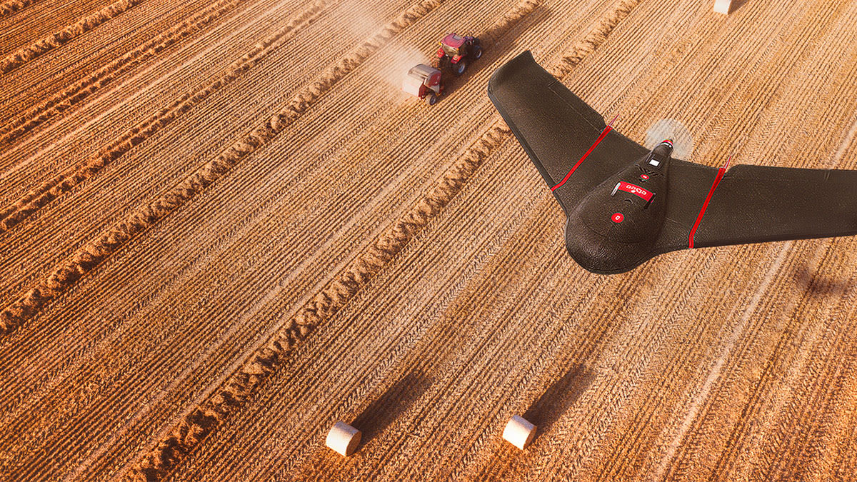
Drone mapping for agriculture
Caroline: Why is drone-mapping relevant for agriculture?
Troy: One word, efficiency. The agriculture industry has suffered from insufficient information about its fields since the beginning of time. Scouts have spent days wandering through fields, trying to gather critical information about the health and success of their crops.
Now, with a combination of our drones and mapping software, we’re able to collect images and build a map showing meaningful data in under an hour. What’s more, with Pix4Dfields that data can be processed and assessed from the field. It’s a game-changer.
Learn more in our exclusive webinar
Discover how to leverage and implement digital agriculture technologies in your workflows in our free webinar.
The beauty is that it allows growers to build a library of knowledge about their fields in a reliable and repeatable way, and combine it with data that they already have. Overall, it allows them to remove a layer of uncertainty and make more efficient decisions for their crops and ultimately their livelihoods.
Pix4D + senseFly: college sweethearts
Caroline: senseFly has recently celebrated its 10th anniversary - congratulations! Pix4D and senseFly have worked in cooperation for the majority of that time as they were both founded at the EPFL university in Switzerland. Can you tell us a little about senseFly?
Troy: senseFly was founded in 2009 but really got going in 2010. We have offices in Lausanne, Switzerland and Raleigh, North Carolina, but equally important, we have a trusted network of around 90 global dealers. Our dealers represent our brand, sell our products and offer services to our clients; they are incredibly valuable to us.
Caroline: What would you say makes senseFly unique?
Troy: senseFly has over a decade of experience, customer feedback and flight hours that have guided us to develop market-leading drone solutions across multiple industries. Considering that the commercial drone industry has only been around a few years longer than that, our experience places us at the forefront of the field, no pun intended!
Caroline: Can you remind me of senseFly’s main products for agriculture?
Troy: Our focus since day one has been creating reliable, usable and scalable aerial-mapping data collection solutions. We have four fixed-wing drones. The eBee X has seven interchangeable payloads across three types of sensor: RGB, multispectral and thermal. The multispectral options include the Sequoia+ by Parrot and the RedEdge-MX by MicaSense.
The eBee SQ has a built-in Sequoia+ multispectral sensor. We’re also one of Trimble’s prefered partners for agriculture.
A digital agriculture workflow with drones
Caroline: Can you go over the practical workflow that you recommend when using senseFly drones with Pix4Dfields software?
Troy: Absolutely. The whole idea here is to make the workflow simple and efficient. A practical workflow using our drones and Pix4D software would involve a farmer preparing their mission using our flight planning software before going into the field. Then they’d take their drone to the mission area, setup, do the pre-flight checks and launch the drone.
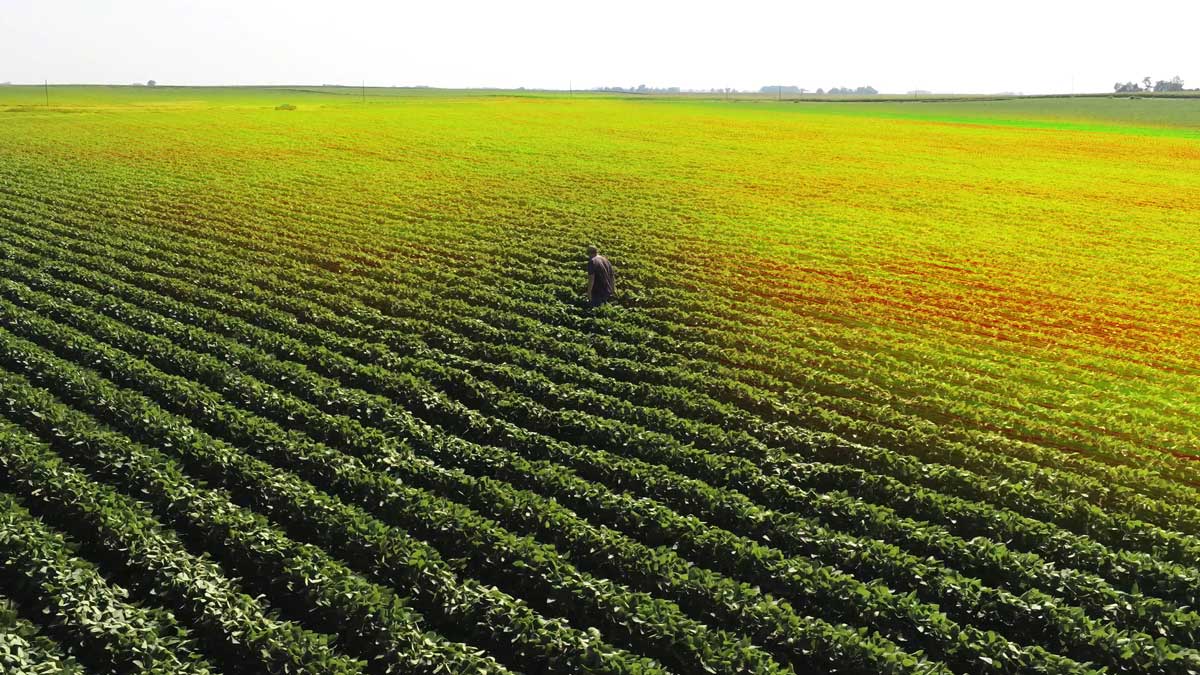
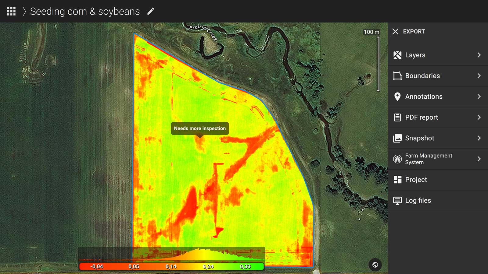
The drone would then map the field and the resulting images are then processed using Pix4Dfields, usually within minutes. No need to head back to the office or anything like that. From there, it’s just a matter of analyzing the data. You can check the variability of your crop and decide if you need to do some specific scouting in areas that look problematic or decide to do an application of herbicide, insecticide, fertilizer, and so on.
Know your crop, act early
Caroline: Do you have any stories you’d like to share, where this workflow has really helped a client?
Troy: At the start of the growing season, it’s important to understand moisture content before sowing seed. It’s difficult to know the soil moisture variation across a large field - you’re often relying on uncertain data from field workers. With drone-mapping, you can now fly and create a 2D orthomosaic, which will show you darker soil or standing water. Having this knowledge within minutes saves a day of scouting a field on foot and avoids seed being wasted in areas where it’s too wet to grow.
But it’s not just traditional ag projects where senseFly drones are helping agriculture professionals. For example, we worked on a case study with Ryan Moore (Owner M&M Ag Consulting, LLC). The purpose of Ryan’s research was to see whether drones were a viable alternative method to collect elevation data for making water management designs, specifically earthwork, rice levees and field drainage ditch placement designs.
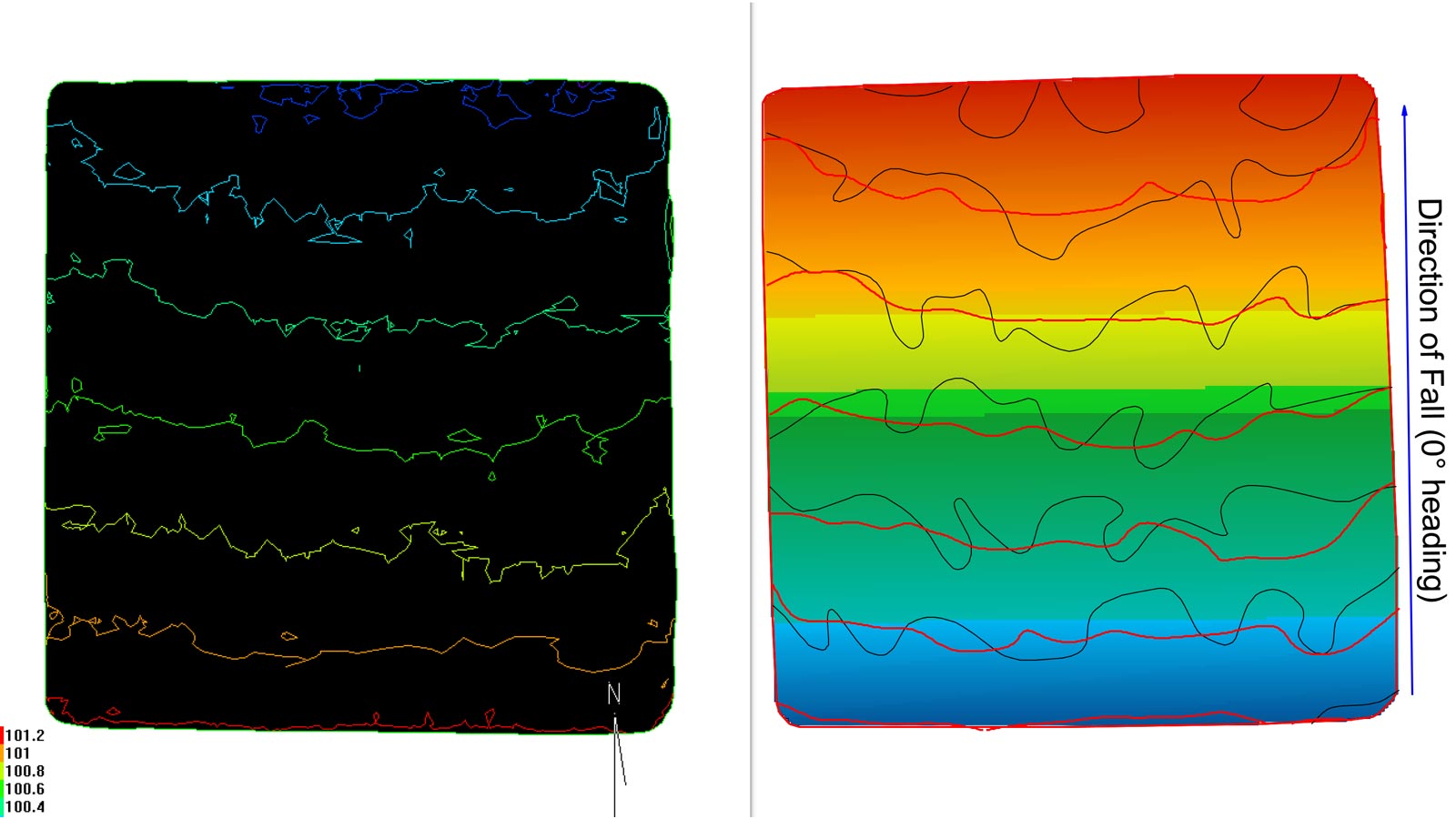
He surveyed a 40-acre field using senseFly drones and surveyed the same field using traditional terrestrial surveying methods. He was able to survey the entire field with his drone in 20 minutes versus an hour with a vehicle. Finding the contour lines and earthwork designs as similar enough, Ryan concluded his senseFly drone was a much more effective option when it came to more time-consuming terrestrial surveying methods.
When it came time to do the terrestrial survey, the soil was too damp to drive the vehicle across, but he was able to fly the drone that day and start analyzing the elevation. In addition, he had to wait two more days for it to be dry enough to do the ground survey. Two days is a significant amount of time and can be a major limiting factor in agriculture, especially when tasks need to get done quick and efficient.
With accurate data to reliable insights
Caroline: How do you see this technology meeting the challenges of today and expanding into the future?
Troy: The main challenge I see is gaining the trust of the Agriculture industry by showing them how drone-mapping technology can really work for them today. We need to prove that the data we’re providing is accurate, reliable and leads to a return on investment. Adoption will follow when the industry understands the benefits and the best practices have been validated.


