Football turf fixed in 1 hour with PIX4Dfields
DigitalAgro is a Uruguayan precision agroforestry services company located in the city of Fray Bentos. Their services include sowing, fertilization, and the application of plant protection products using drones and mapping software.
The football institution The Institución Atlética 18 de Julio recently hired DigitalAgro in order to treat the turf on their football fields with the goal of providing high-quality turf quickly. Maintaining field turf is crucial for player safety and ensuring optimum play.
The challenge: bring the green back
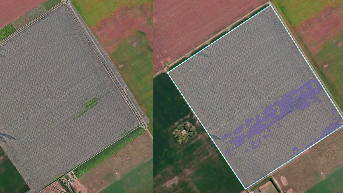
The Institución Atlética 18 de Julio had a problem: their football field was suffering from years of neglect, with soil compaction and erosion, resulting in poor vegetative cover. For DigitalAgro, the challenge wasn't just fixing a struggling pitch—it was doing it sustainably and fast. To improve the vegetation cover of the football pitch, the DigitalAgro team carried out an aerial survey. They used a drone to identify those areas of the pitch with the least vegetation, with PIX4Dfields to process the drone data.
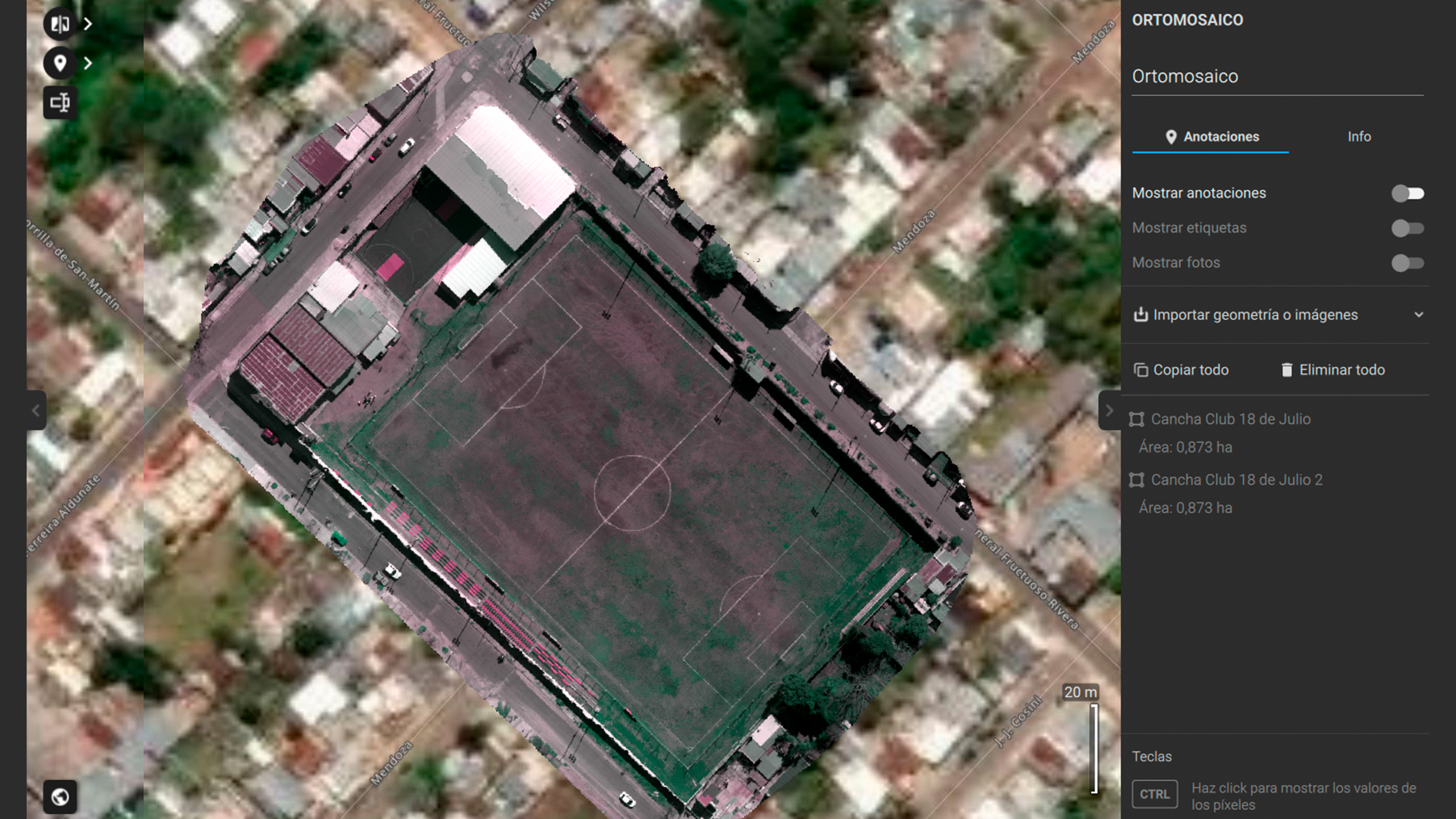
The team mapped the field, identified every bare patch, and created a precise treatment plan with just 10 minutes of processing time. Here’s how they achieved total turf regeneration:
Fast and offline results: the images were processed immediately on a laptop using PIX4Dfields. The critical advantage? The software works completely offline—no waiting for internet access in the field.
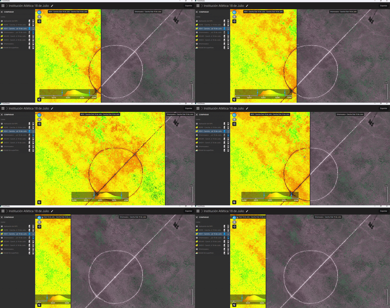
Instant diagnosis: by using the Index Generator in PIX4Dfields, they instantly identified NDVI/NDRE maps showing poor vegetation and nutrient-deficient soil. They then used this data to target the bare areas for two phases of treatment: first, applying effective microorganisms to start the soil microbiota regeneration, and second, applying nutrients to prepare the soil for subsequent Ryegrass sowing.
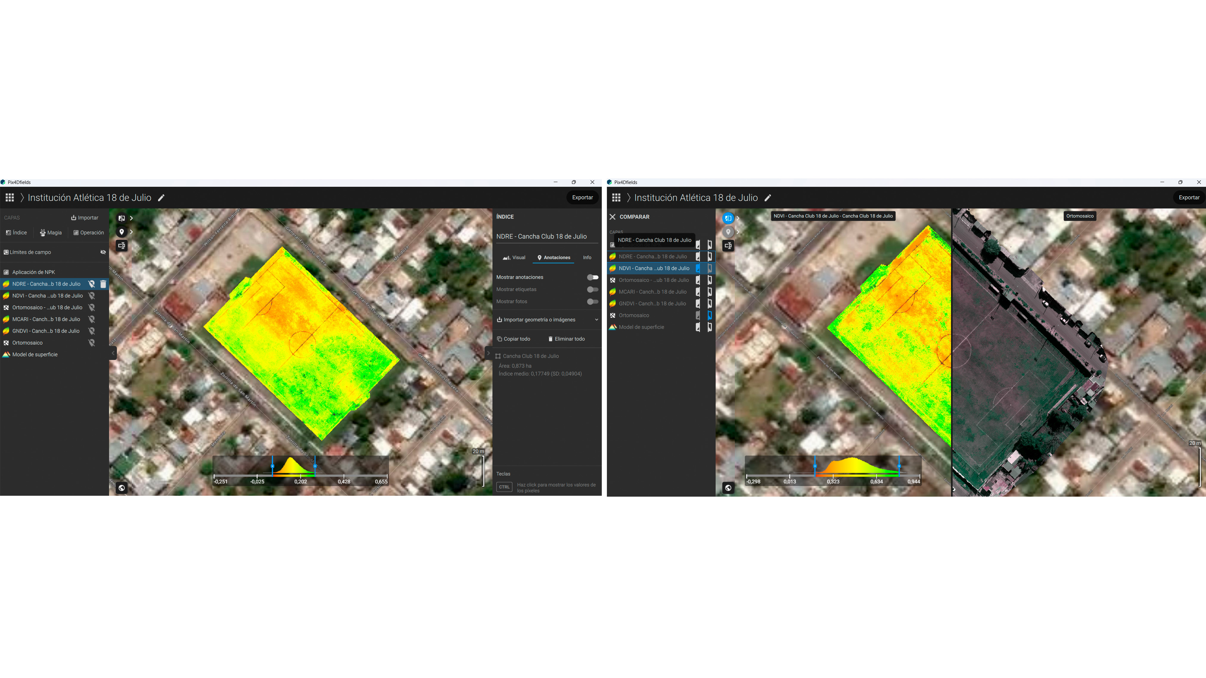
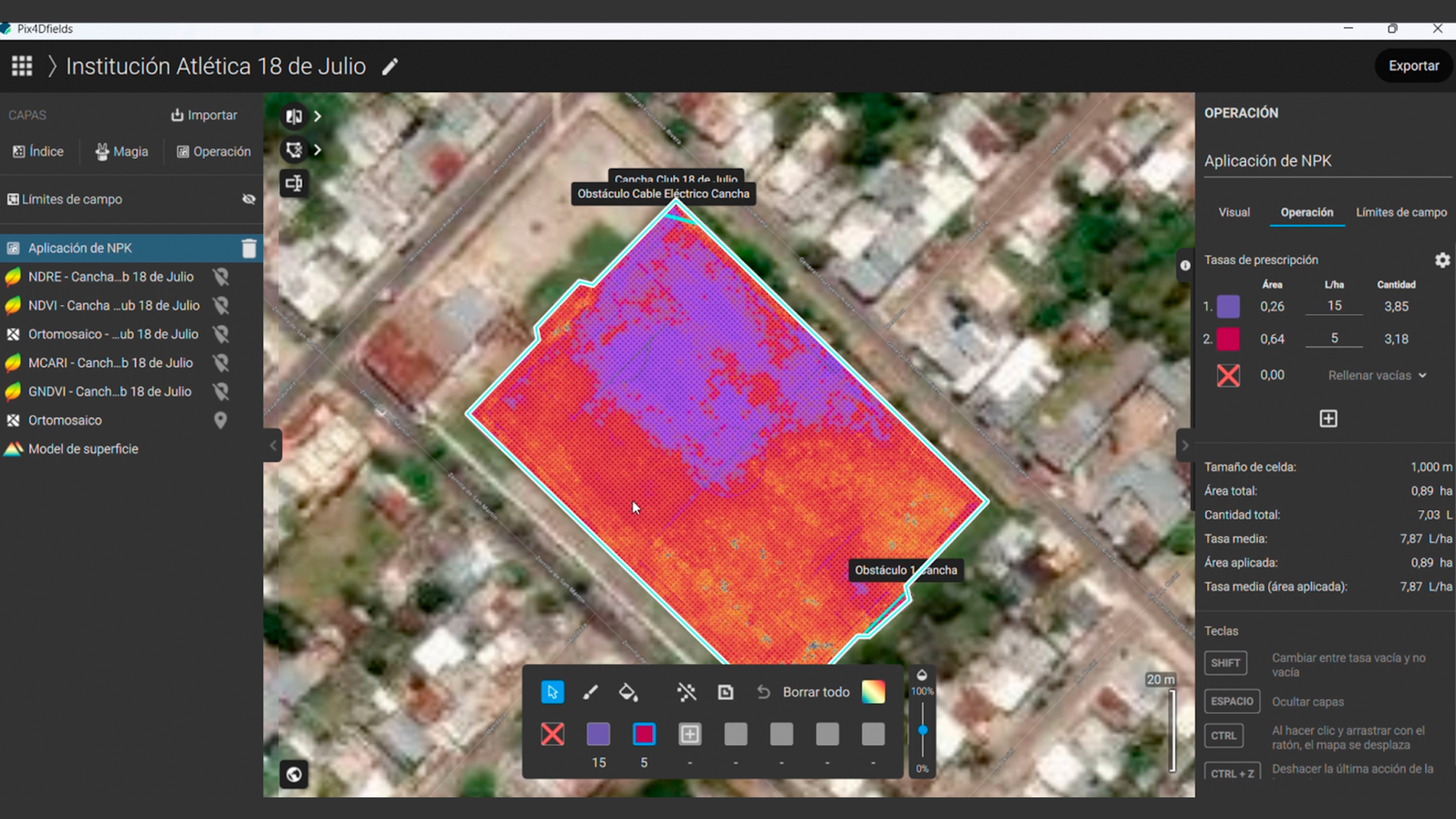
- Targeted prescription: identified all areas on the field with lower photosynthetic activity using PIX4Dfields’ Magic Tool and directly created a prescription map for a targeted fertilizer application with a spray drone.
- Easy export: the prescription map was directly exported to the spray drones for targeted fertilizer application. Whether the team used an XAG or a DJI agricultural drone, PIX4Dfields ensured the application map was ready to fly with zero friction.
Project Details
| Location | Uruguay |
| User | DigitalAgro |
| Project duration | 1 hour |
| Area surveyed | 89 hectares |
| Software used | PIX4Dfields |
| Hardware used | DJI Mavic 3 Enterprise |
Healthy turf plus fertilizer savings
The precision application delivered two major wins: it was more sustainable as it only used products where needed, and it was significantly more cost-effective.
By applying fertilizer selectively based on the PIX4Dfields prescription map, the client achieved a 78% saving on product. With a dose of 15 liters per hectare at £18 per liter of ME, the financial savings amounted to £210 from this single application alone.
The fast turnaround and guaranteed precision helped DigitalAgro secure more work:
"We have acquired new services on new soccer fields and also on golf courses, which fills us with joy." - Ernesto Claramunt, Environmental Control Technician at DigitalAgro
For DigitalAgro, the choice of software was clear:
"We chose it for its versatility because it is a very intuitive software once you start using it and because it can be used in the field without internet." - Ernesto Claramunt, Environmental Control Technician at DigitalAgro
PIX4Dfields allowed DigitalAgro to deliver a high-value service that is safer, healthier, and more sustainable for the environment and the client's budget.
“With PIX4Dfields, we have been able to generate added value to our agricultural drone operations, making them safer, healthier, and more sustainable. The producer's pocket and the environment also appreciate it."- Ernesto Claramunt, Environmental Control Technician at DigitalAgro


