
Making a cup last: protecting coffee plantations with drones
Coffee is drunk all over the world. In the US, it is estimated 75% of adults drink coffee. The country with the highest coffee consumption is Finland, where the average person drinks up to 4 cups of coffee a day.
Coffee as a crop is grown in more temperate or tropical climates. It needs plenty of sunshine, consistent rain, and no dips in temperature that could bring in a frost. With climate change threatening coffee crops across the world, it is becoming more and more important to optimize coffee yields and ensure the crops are healthy.
This is where drone mapping and remote sensing come in. By using drones and specialized agricultural mapping software, it is possible to detect disease in coffee crops early, or to monitor crop yields. You can even automate monitoring and detect crop behavior or disease with special algorithms.
Coffee is a critical crop in Costa Rica. All coffee grown in the country is either of the Caturra or Catauai varieties, which are originally Arabic strains. This is partly a result of coffee controls and law changes in the 1980s intended to cultivate highly effective and strong crops with better yields. Costa Rica is currently one of the most important coffee producers in the world, with over 1.5 million bags of coffee beans grown and exported every year.
Drone mapping research for optimizing coffee yields
CoatzaDrone provides drone mapping services in Latin America, with projects ranging from mapping solar farms with drones to digitizing archaeological artifacts. CoatzaDrone has recently entered into a collaboration with Green Xpo Lab, which is aligned with the School of Agricultural Economics and Agribusiness at the Universidad de Costa Rica. The collaborative project between these partners is focused on researching and monitoring coffee crops in Los Santos, Costa Rica.
The research is being conducted by a team of students and researchers which includes specialized engineers and horticulturalists. Together, they are exploring how remote sensing with PIX4Dfields and drones can be used in this mountainous terrain to better monitor and tend to coffee crops.
Project details
| Location | Los Santos, Costa Rica |
| User | CoatzaDrone |
| Software | PIX4Dfields |
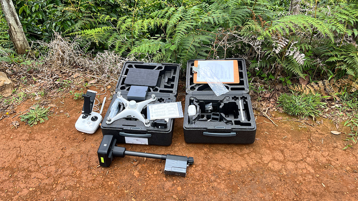
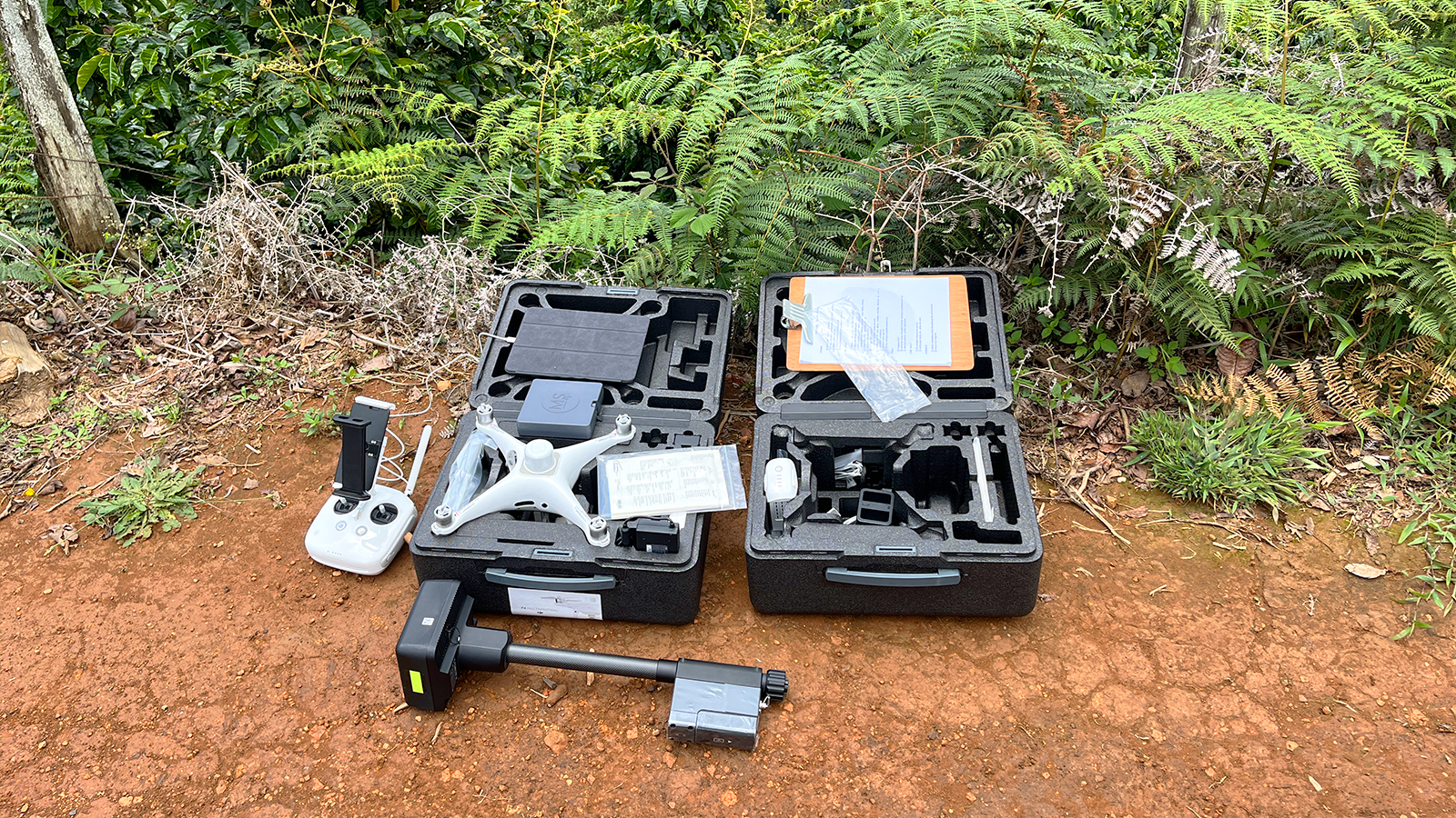
| Hardware | DJI Phantom 4 multispectral |
| Area surveyed | 5 ha lots |
| Processing time per lot | RGB: 1 hour Multispectral: 2 hours |
| Images captured per lot | RGB: 245 Multispectral: 1225 |
| GSD | 3 cm |
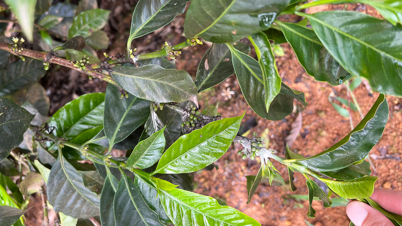
Drone mapping coffee fields
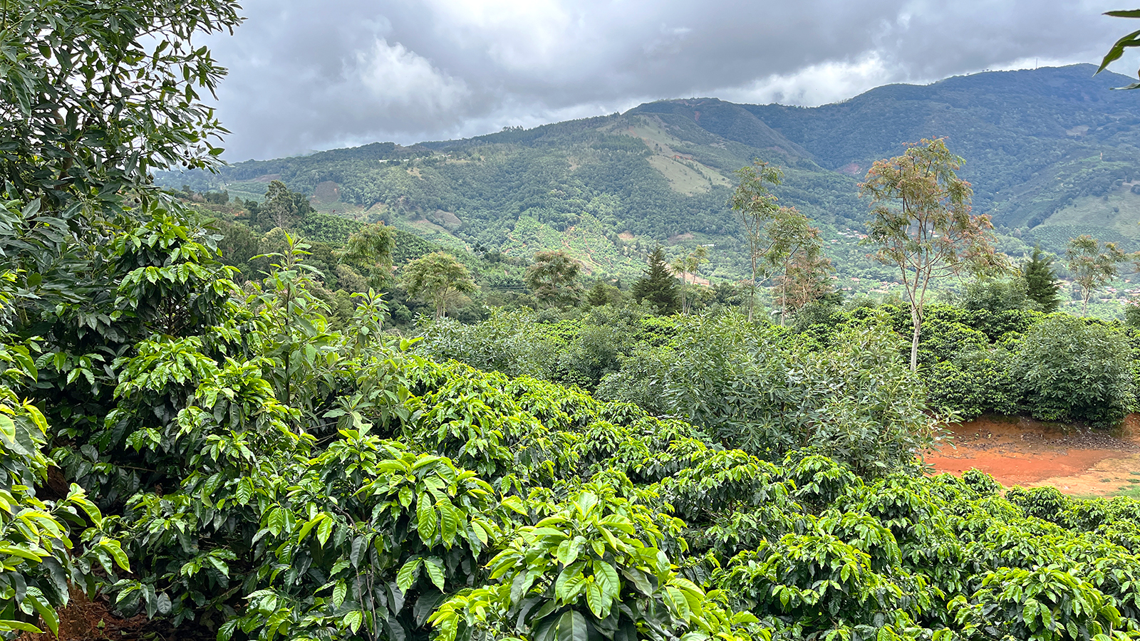
The coffee plantation being surveyed is in Los Santos, a mountainous area of Costa Rica. The region has volcanic soil with low acidity, which makes it ideal for coffee crops. Over 80% of this coffee growing region is situated between 800 and 1,600 meters above sea level with the average temperature fluctuating between 17 and 18 degrees Celsius (63 degrees Fahrenheit). Similar to other tropical climates, the annual rainfall is between 2,000 to 3,000 millimeters. All of these conditions combine to make it an ideal location to plant and cultivate coffee.
The Green XPO Lab and CoatzaDrone team have set out to gather data throughout the growing season. They will fly on 7 different dates over 2 specific lots measuring 5 hectares. These lots will be studied using PIX4Dfields throughout the growing season to identify any problems, monitor crop vigor, and analyze plant health needs such as fertilizer or pesticide. The data collection began in May 2022 and will continue until June 2023.
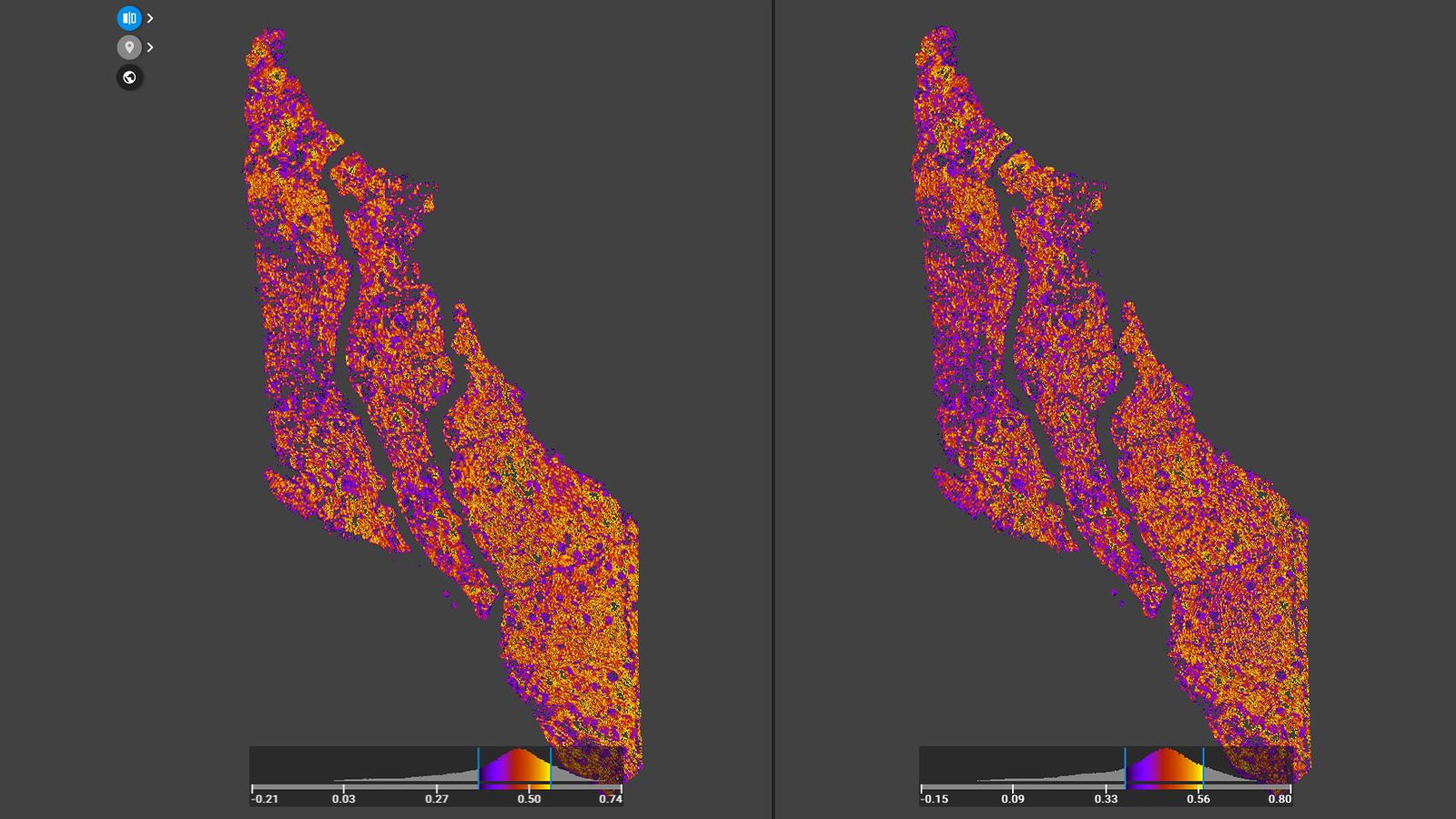
The drone being used for this project has a multispectral sensor, making it ideal for getting crop analytics. Through multispectral imagery, the team can use PIX4Dfields to generate vegetation indices. The software analyzes how a plant reflects light to determine its health. These indices can show if a region of the field is showing signs of poor health, which can be an indicator of disease. Specific diseases can also be identified with crop growth patterns that can be identified through vegetation indices. Alternatively, nutritional deficits can be spotted using a specialized vegetation index, such as monitoring crop nitrogen levels.
The benefits of this form of remote sensing and crop analysis include:
- Reducing yield loss or low-quality harvests
- Early detection of disease and prevention of spread, including using geolocation data to mark diseased areas
- Saves resources for producers through spot treatments
- Easy access to crops despite difficult terrain
The entire workflow of data collection, processing, and analysis can be completed within 12 hours. The data can be shared online, via the PIX4Dfields share to PIX4Dcloud function, or through customized reports or printed/shared outputs.
Using multispectral and RGB imagery for vegetation indices
Vegetation indices are a key element of precision agriculture. They help farmers to learn more about their crops and are used in a variety of ways.
The RGB and multispectral imagery captured with the drone in this project are producing different vegetation indices that can be used at various stages of the crop cycle. With PIX4Dfields, the team is also creating 2D maps (orthomosaics) and digital surface models (DSM) to analyze the coffee plantation's topography.
“This is a special project because we want to show coffee growers how useful remote sensing technology is. We also want to improve coffee production and do it in a sustainable, environmentally friendly way,” - Alvaro Ruiz, CoatzaDrone
Thanks to crop mapping with PIX4Dfields, the coffee growers in the region are discovering the benefits of remote sensing with drone mapping in agriculture and enhancing their crop care techniques.


