

Pix4D articles featured in the Drone Radio Show podcast
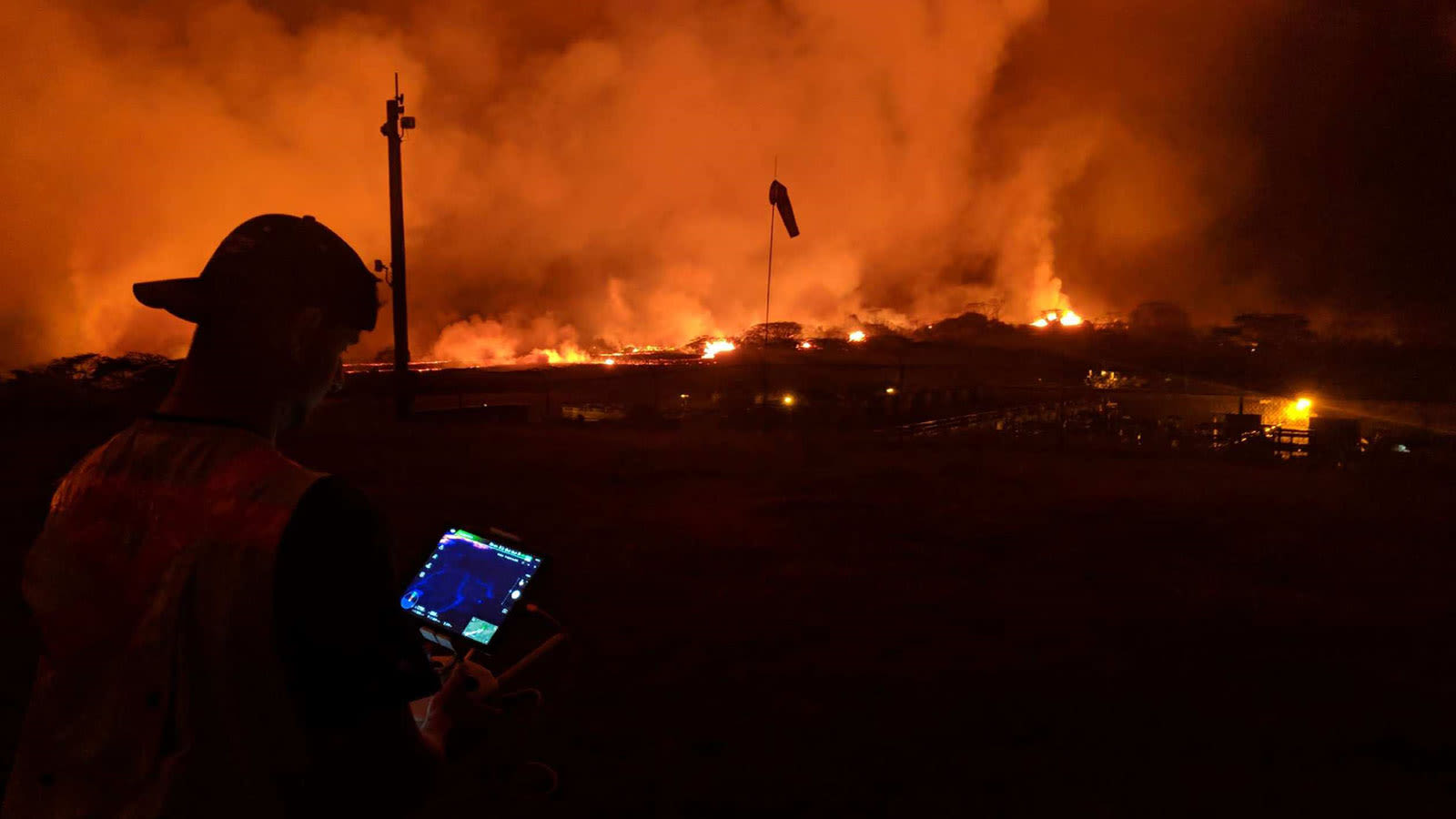
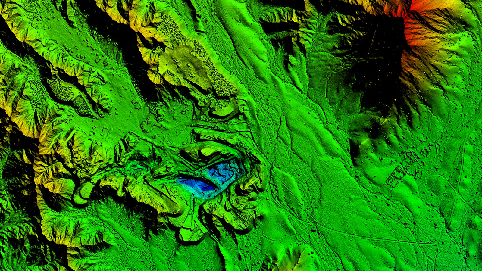
Mapping the Kilauea volcanic eruption with drones
As lava flowed through Hawaii’s big island, drones and Pix4D helped map the disaster in minutes.

Registrations for the Pix4D User Conference are open!
Join other Pix4D users, drone enthusiasts and GIS-perts in Denver for two days of talking about tech that’s changing the world. Register now.
Pushing the limits: mapping large areas with drones
Join us for a free webinar on processing unusually large datasets - over 150,000 images!
Start drone mapping for free!
Discover Pix4Dmapper. Professional drone mapping, purely from images.